
Dalton Highway Updates
2015 Flooding Response
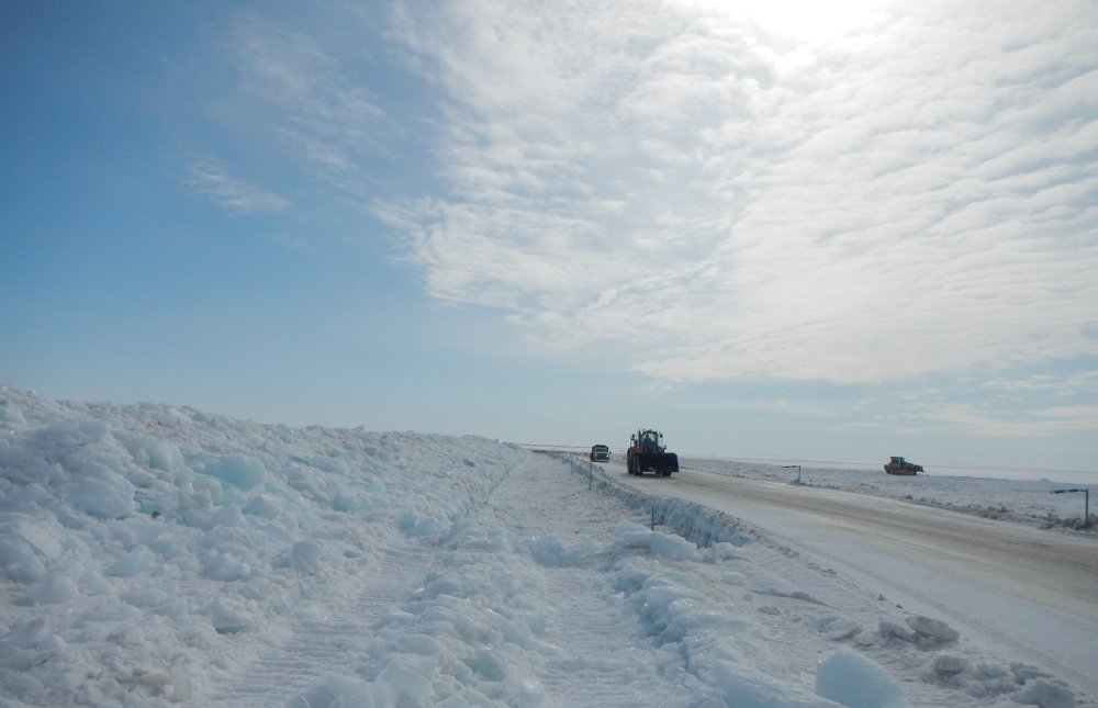
On March 13, 2015, crews from the Alaska Department of Transportation & Public Facilities (ADOT&PF) began working to keep overflow away from the Dalton Highway. This overflow was the result of ice accumulating at the bottom of the shallow and braided Sagavanirktok (Sag) River. The ice pushed the flowing water to the top, though temperatures in the area remained below freezing.
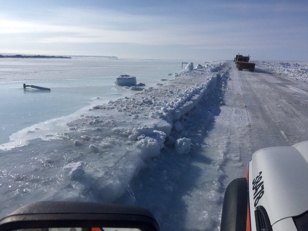
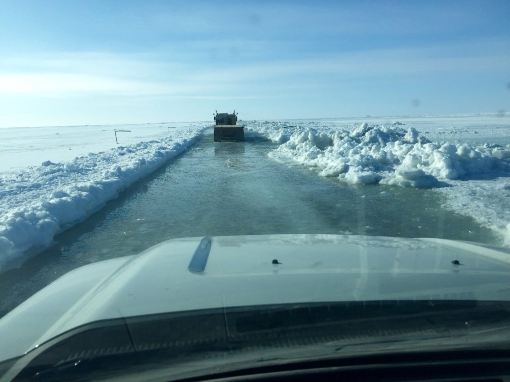
Initially, the water overflow caused intermittent road and lane closures. In early April, the Dalton Highway between Mile 395 and 405 closed for seven days. ADOT&PF and contractor crews battled the overflow by building snow berms along the road and by creating an extensive system of trenches to divert water away from the highway.
This initial overflow incident resulted in the first of two disaster declarations by Alaska Gov. Bill Walker regarding the winter/spring flooding. ADOT&PF collaborated with industry representatives and stakeholders as part of the Unified Incident Command (UIC) to respond to the disaster and successfully reopen the Dalton Highway. Engaged stakeholders included: the Alaska Trucking Association, BP Alaska, ConocoPhillips, ExxonMobil, ENI Petroleum, the North Slope Borough, Lynden Transport, Carlisle, Peak Oilfield Services, Alyeska Pipeline Service Company and others.
On May 22, 2015, the arrival of spring breakup on the North Slope brought another round of flooding, this time on a larger scale than the area had ever seen. Water washed out several sections of the highway and inundated Deadhorse and surrounding areas.
Gov. Walker proclaimed a second disaster declaration, which included the entire North Slope Borough and the Dalton Highway.
On June 5, 2015, the road reopened to traffic. Emergency repairs continued into July, when activity transitioned from repairs to construction work. During the 2015 construction season, the grade of the road from Mile 397-405 was raised 8-10 feet, making the road in that section significantly higher than when it flooded earlier in the year.
The impacts of the ice and flooding were dramatic:
• 24 miles of the road were impacted;
• 28 days the road was closed;
• Two state disaster declarations issued; and
• $17 million for emergency repairs.
To view photos and video of the 2015 Dalton Highway flooding response, visit http://bit.ly/1E7IaBT
June 5, 2015 8:30am
Dalton Highway reopens to traffic
ADOT&PF thanks stakeholders; work transitions from emergency to construction project
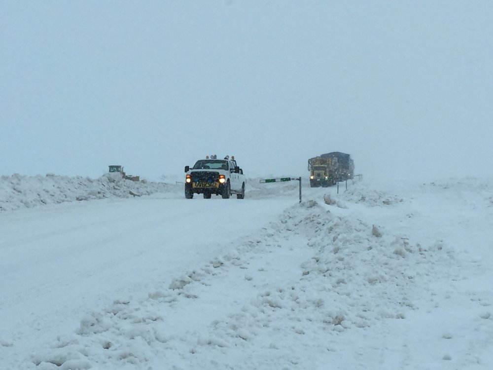
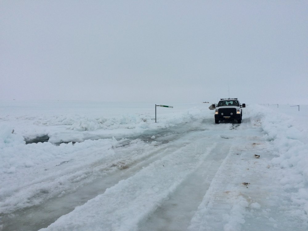
(PRUDHOE BAY, Alaska) — The Dalton Highway has reopened to traffic after an 18-day closure caused by massive spring breakup flooding.
Traffic began moving on the road at 8 a.m. this morning. The highway is open to two-way traffic, but drivers will encounter a section with flaggers and pilot car at Mile 412-414. The road remains in rough condition through the flood zone at Miles 392-414, with multiple narrow sections and an uneven surface. Drivers are urged to travel slowly and watch for signs.
The reopening of the highway marks a milestone for the Alaska Department of Transportation and Public Facilities (ADOT&PF), which has been handling the Dalton flood response since the initial overflow problems in March. The cost of this spring’s emergency response totals $15.5 million.
Flooding on the section of highway south of Deadhorse began in mid-March when overflow from the Sagavanirktok (Sag) River began spilling onto the highway. River aufeis accumulated in the bottom of the shallow and braided river and pushed the flowing water to the top, though temperatures in the area remained below freezing.
The water resulted in intermittent road and lane closures before eventually forcing a seven-day shutdown of the road between Miles 395-405 in early April. ADOT&PF and contractor crews battled the overflow by creating an extensive system of trenches to divert water away from the highway and by reinforcing berms along the road.
This initial overflow incident resulted in the first of two disaster declarations by Gov. Walker regarding the spring flooding.
On May 22, the arrival of spring breakup on the North Slope brought another round of flooding, this time on a larger scale than the area had ever seen. Water washed out several sections of the highway and inundated Deadhorse and surrounding areas. With this, Gov. Walker proclaimed a second disaster declaration, which included the entire North Slope Borough, including the highway.
Throughout the two-and-a-half-month response effort, ADOT&PF has been coordinating with industry representatives and stakeholders, including the Alaska Trucking Association, BP Alaska, ConocoPhillips, ExxonMobil, ENI Petroleum, the North Slope Borough, Lynden Transport, Carlisle, Peak Oilfield Services, Alyeska Pipeline Service Company, and others.
“We want to thank everyone involved in this incredible effort,” said Mike Coffey, ADOT&PF Statewide Director of Maintenance and Operations and the State Incident Commander. “We would not be opening the road today without the cooperation and teamwork of every single stakeholder.”
The reopening does not mean an end to repairs and other work on the highway from Miles 392-414. While the initial emergency repairs have been finished, a planned construction project will start this summer between Miles 397-414, which will raise the grade of the road 3-7 feet and install culverts. That project is being constructed by Brice with an initial contract cost of $27 million, a supplemental agreement is still being finalized for work beyond the original contract. Other projects currently in design will address the road south of Mile 392.
A timeline and photos of the flooding and response efforts are available at the following websites:
- Dalton website, with photos: https://dot.alaska.gov/nreg/dalton-updates/
- Travel conditions: 511.Alaska.Gov or call 511
- ADOT&PF Facebook: www.facebook.com/AlaskaDOTPF
- ADOT&PF Twitter: @AlaskaDOTPF
- ADOT&PF Flickr: https://flic.kr/s/aHskab652W
The Alaska Department of Transportation and Public Facilities oversees 249 airports, 11 ferries serving 35 communities, 5,619 miles of highway and 720 public facilities throughout the state of Alaska. The mission of the department is to “Keep Alaska Moving through service and infrastructure.”
Photos: Top-The first vehicles traveling south on the Dalton Highway, Mile 413. Bottom-Trucks heading north near mile 412.
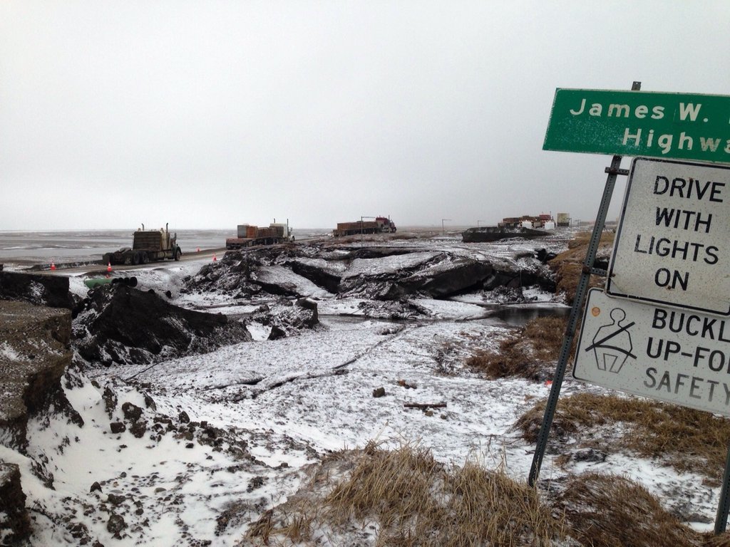
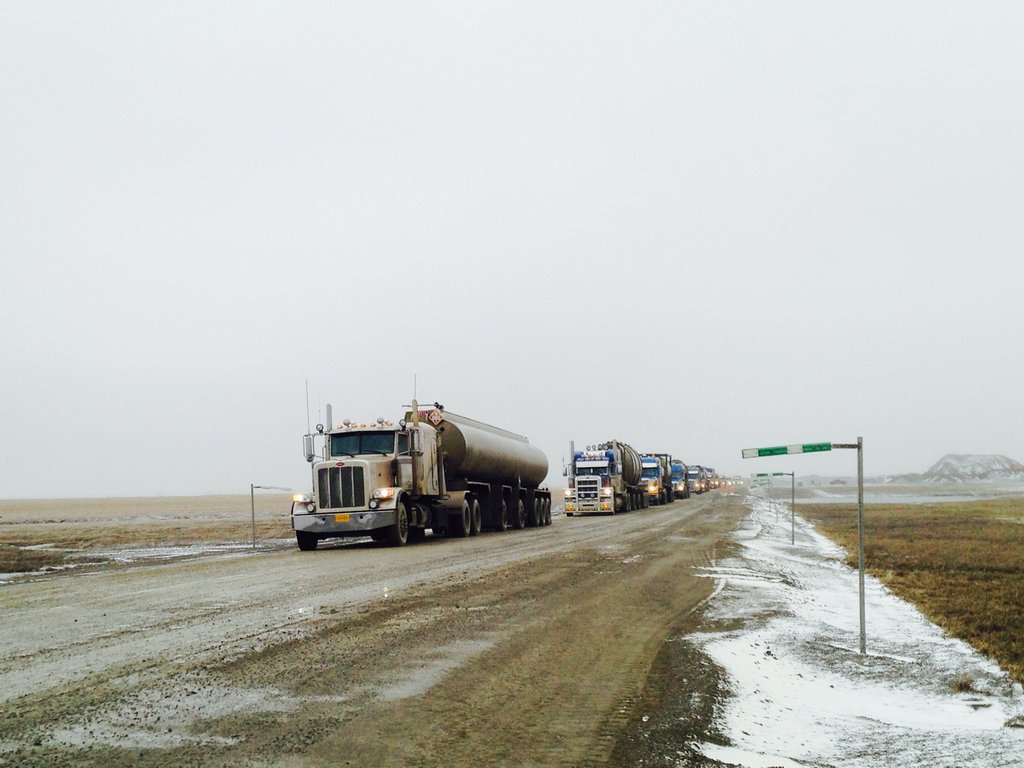
Photo ADOT&PF Click on image for larger size.
June 1, 2015 8:30am
The road will reopen at 8 a.m. Friday, June 5. We plan to keep the highway open to traffic 24 hours a day.
The gap between when the road reopens and when planned construction work begins is shorter than we previously thought. Because of that, we decided that the best way to ensure a smooth transition between the emergency repairs and the construction project is to use flaggers and pilot cars for traffic control through the one-lane sections instead of signs. We will still continue to perform heavy duty repairs in areas, as well.
When the road reopens, drivers can expect typical construction project conditions. We do not anticipate having any restrictions on load size or widths, but drivers should be aware that the road will be very rough and narrow in some sections through the flood zone. There also will be multiple work locations with traffic control at those locations.
Photos: Photo from the air was taken Saturday, May 30. Photo of the road from the ground is from Sunday, May 31.
Photos ADOT&PF: Click on image for larger size.
May 29, 2015 noon
ADOT&PF sets tentative date for reopening Dalton Highway
Department plans to open the road June 5, contingent on weather and progress of repairs.
(FAIRBANKS, Alaska) — With repairs progressing on the Dalton Highway, the Alaska Department of Transportation and Public Facilities (ADOT&PF) has set a tentative reopening date of Friday, June 5. This date is dependent on weather and repair progression, among other factors.
ADOT&PF warns travelers that the road surface will be rough and narrow through the flood zone. The department aims to have a road width of at least 20 feet through the project zone, but there will likely be sections of road that will be one lane with delineators or yield signs. This is to allow traffic to the North Slope to resume as soon as possible.
Repairs are progressing on both the north and south ends of the flood zone. On the south end, crews have progressed to just north of Mile 397 and will be going back to install culverts today. On the north end, contractor staff are repairing a culvert pipe that failed early this morning near Mile 412.5 and will bridge a breach just north of Mile 412.
Challenges still remain for the repairs. The material being hauled is saturated with water, so it is taking days of grooming to make patches drivable.
The highway is closed from Mile 335 to Mile 413.
Updates on the Dalton Highway are being posted in these locations
- Dalton website, with photos: https://dot.alaska.gov/nreg/dalton-updates/
- Travel conditions: 511.Alaska.Gov or call 511
- ADOT&PF Facebook: www.facebook.com/AlaskaDOTPF
- ADOT&PF Twitter: @AlaskaDOTPF
- ADOT&PF Flickr: https://flic.kr/s/aHskab652W
The Alaska Department of Transportation and Public Facilities oversees 249 airports, 11 ferries serving 35 communities, 5,619 miles of highway and 720 public facilities throughout the state of Alaska. The mission of the department is to “Keep Alaska Moving through service and infrastructure.”
Photos: Repair work progresses on the Dalton Highway, Mile 413, in this aerial photo from Thursday, May 28.
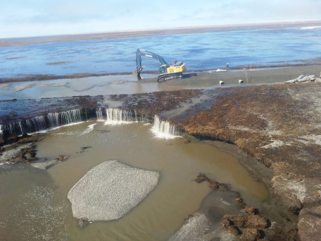
Photo ADOT&PF Click on image for larger size.
May 27, 2015 10:45am
With water continuing to recede in the flood zone, crews have been working on repairs and hauling material for repairs on both ends.
One challenge we face now is the distance from the material sites to the damaged sections of the road. To help improve efficiency for repairs, crews are working to develop material pits closer to the flood area.
Photos: Repair work is ongoing on both ends of the flooded section of the Dalton Highway.
Photos ADOT&PF: Click on image for larger size.
May 24, 2015 7:00pm
Crews Starting Repair Work on the Dalton Highway
Road remains closed, but water levels have dropped considerably.
(FAIRBANKS, Alaska) –This evening, during the daily briefing, Mike Coffey, Maintenance and Operations Director for the Alaska Department of Tranpsortation and Public Facilites, could barely contain his enthusiasm as he shared with the Dalton Unified Incident Command that flood levels had dropped enought to start repair work immediately.
"This is a good day," said Coffey. "Over the next 24-hours activity will ramp up immensely. This is what we've prepared for and what we've been waiting for. Today we were able to give crews the directive to start repairing the Dalton Highway to reestablish the lifeline to Prudhoe Bay and the North Slope A very good day indeed."
On the north end of the Dalton Highway, near Mile 314, culverts are being installed to facilitate the flow of flood waters back into the main channel of the Sag River and to provide access to the Dalton Highway south.
On the south end, near Mile 335, crews will continue to excavate, haul and stockpile materials necessary for rebuilding miles of washed out highway.
The priority at this point is access to materials, such as rock and gravel. The current material sites are far from the areas of damage and the round-trip hauls are inefficient. New materials sites, closer to the washouts, will be developed over the next several days.
The Dalton Highway remains closed from Mile 335.5 to Mile 413. There is no current estimate on when the road will reopen, that information should be available in the next few days, after crews have had a chance to start the repair work.
Updates on the Dalton Highway are being posted in these locations
- Dalton website, with photos: https://dot.alaska.gov/nreg/dalton-updates/
- Travel conditions: 511.Alaska.Gov or call 511
- ADOT&PF Facebook: www.facebook.com/AlaskaDOTPF
- ADOT&PF Twitter: @AlaskaDOTPF
- ADOT&PF Flickr: https://flic.kr/s/aHskab652W
The Alaska Department of Transportation and Public Facilities oversees 249 airports, 11 ferries serving 35 communities, 5,619 miles of highway and 720 public facilities throughout the state of Alaska. The mission of the department is to “Keep Alaska Moving through service and infrastructure.”
May 23, 2015 6:00pm
The Dalton Highway remains closed beginning just north of Happy Valley at Mile 335.5 through Mile 413. The road closure
is anticipated to last well into next week and possibly longer.
Water levels have dropped (as measured by UAF hydrologists) by approximately 16 inches in the main channel of the Sag River prior to the river splitting into the east and west forks.
However, unfortunately we have not seen water levels drop crossing and adjacent to the highway and flooding overall is still daunting.
The Deadhorse Airport remains open 24 hours a day for flights and is currently operating below capacity. The airport and runway are several feet above the water level and DOT&PF staff remain confident that airport operations will not be impacted by the flooding.
According to the National Weather Service flood warning remains in effect until 4:15 p.m. Sunday for the Dalton Highway from MP 394 to Deadhorse.
ADOT&PF staff and contractor crews continue staging equipment and material on the north and south ends of the flood area. Material site development and material production remains a priority, especially the production of riprap.
Photos ADOT&PF: Click on image for larger size.
May 21, 2015 4:30pm
Dalton Highway Remains Closed Due to Flooding
Airport is open 24 hours a day for flights; closure is expected to last several more days.
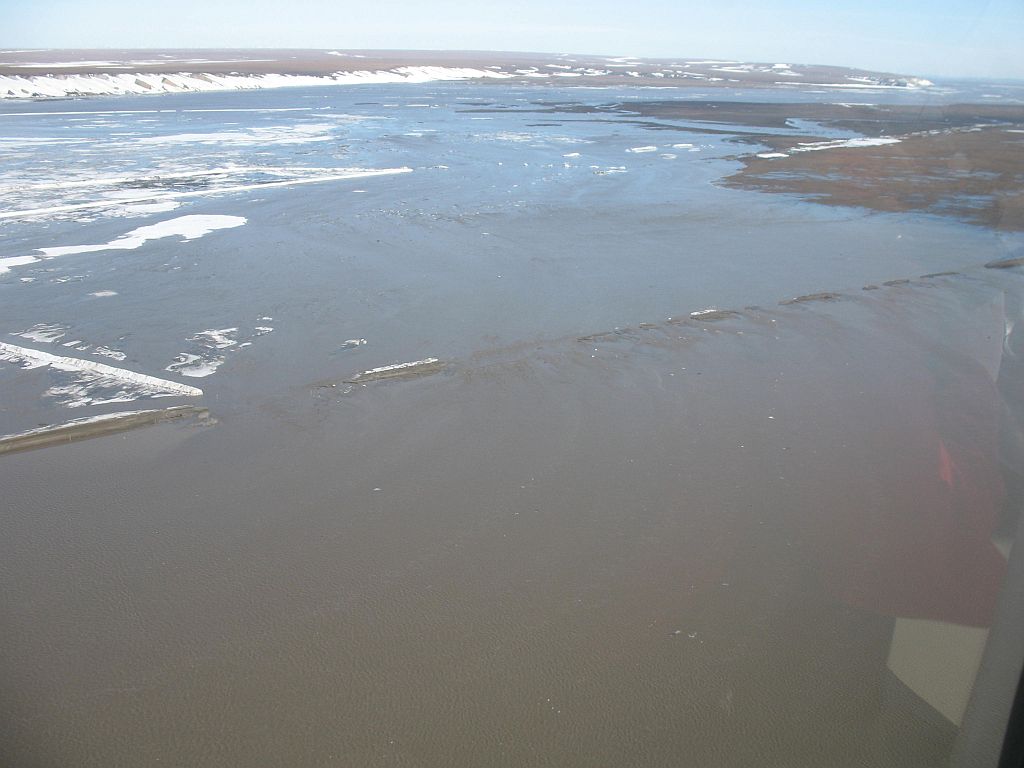
(FAIRBANKS, Alaska) – The Dalton Highway remains closed from Mile 334.5-413 due to flooding. Water levels in Deadhorse and on the Dalton Highway are still very high, but since yesterday, there have been no new areas of flooding. Experts predict that water levels will remain high for the next few days, but this is dependent on weather. The road closure is anticipated to last into next week, at the least.
The Deadhorse Airport remains open 24 hours a day for flights. The airport and runway are several feet above the water level. Alaska Department of Transportation and Public Facilities (ADOT&PF) staff remain confident that operations at the airport will not be impacted. High water yesterday briefly impacted navigational aids, so ADOT&PF crews cut breaches across the access road and MP 413 of the highway as an outlet for the water. The breaches were very successful, water dropped within hours and navigational aids were turned back on.
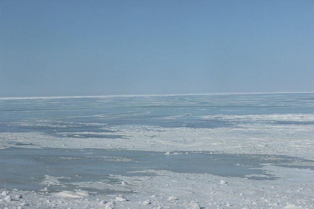
Break-up of the Sag River usually takes approximately four weeks. Unusually high temperatures north of the Brooks Range have caused snow and ice to melt much more rapidly than usual, and the break-up this season is very condensed. The rapid melting of the snow and ice has a greater impact this year because of the ice overflow that occurred in April. There is a large amount of ice remaining in the channels of the Sag River; this ice reduces the channel capacity, causing the water to flood.
ADOT&PF is staging equipment and material on the north and south ends of the flood area. When the flood waters recede, crews are prepared to immediately begin making repairs to the road. The extent of the damage will not be known entirely until the water levels drop.
Hydrologists are documenting the flow and volume of the Sag River during this event. Not many records exist for this area. The information being gathered now will be incorporated into future road construction.
Updates on the Dalton Highway are being posted in these locations
- Dalton website, with photos: https://dot.alaska.gov/nreg/dalton-updates/
- Travel conditions: 511.Alaska.Gov or call 511
- ADOT&PF Facebook: www.facebook.com/AlaskaDOTPF
- ADOT&PF Twitter: @AlaskaDOTPF
- ADOT&PF Flickr: https://flic.kr/s/aHskab652W
The Alaska Department of Transportation and Public Facilities oversees 249 airports, 11 ferries serving 35 communities, 5,619 miles of highway and 720 public facilities throughout the state of Alaska. The mission of the department is to “Keep Alaska Moving through service and infrastructure.”
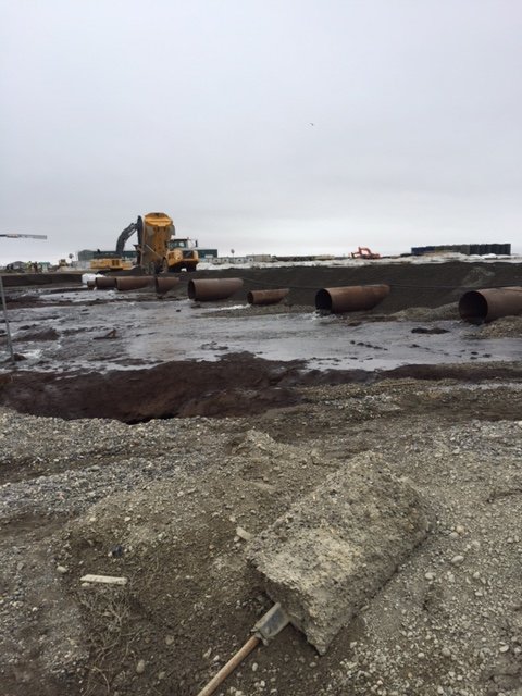
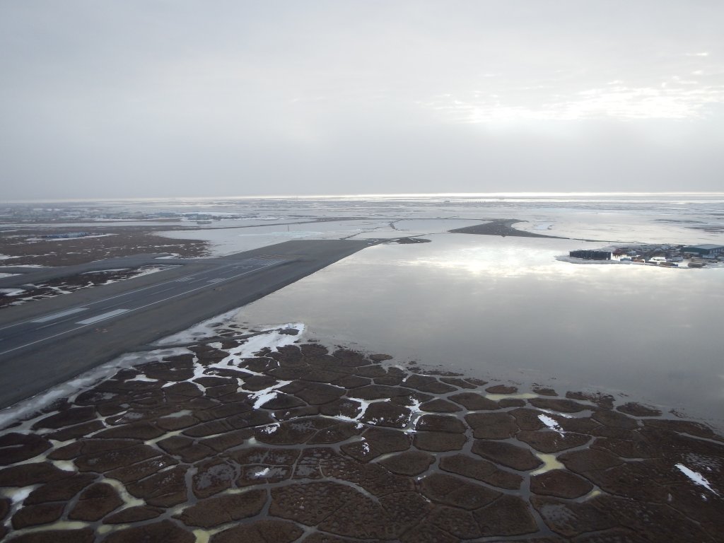
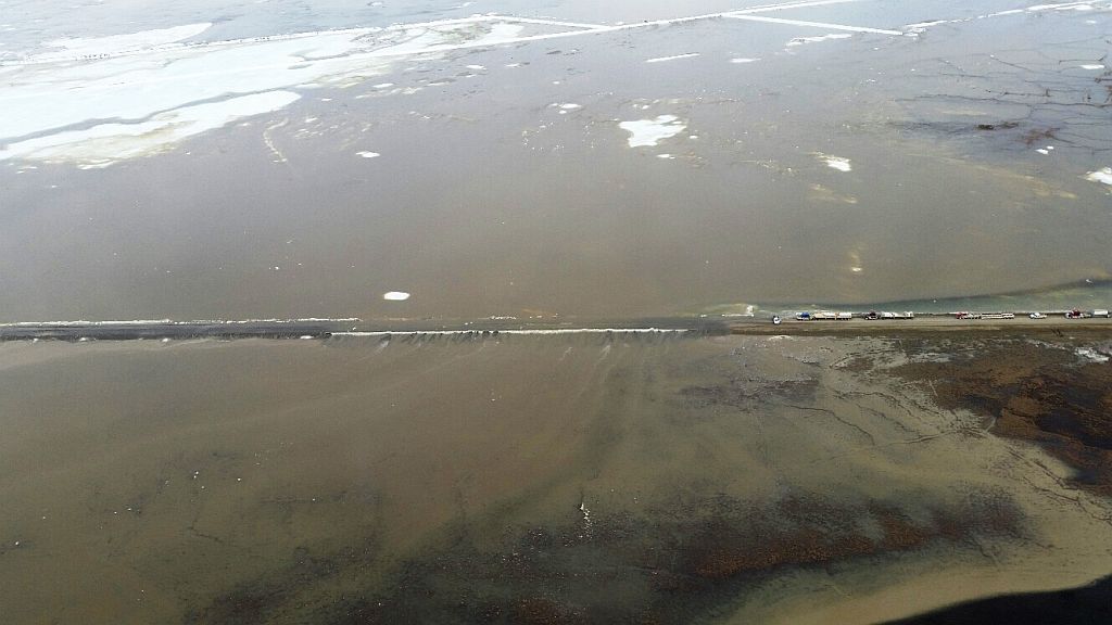
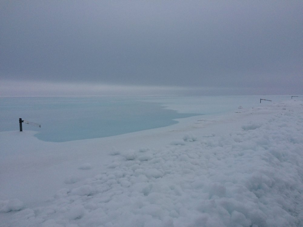
Photos: Dalton Highway mile 413, mile 414.1 4 foot culvert, and the Dalton Airport looking northwest.
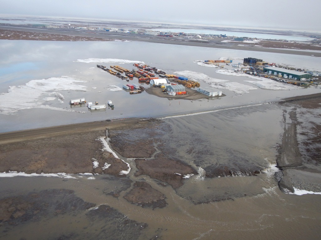
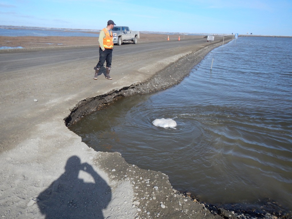
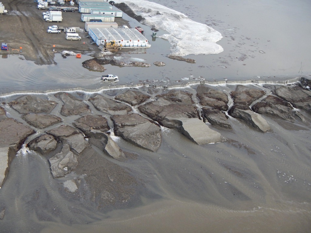
Photo ADOT&PF Click on image for larger size.
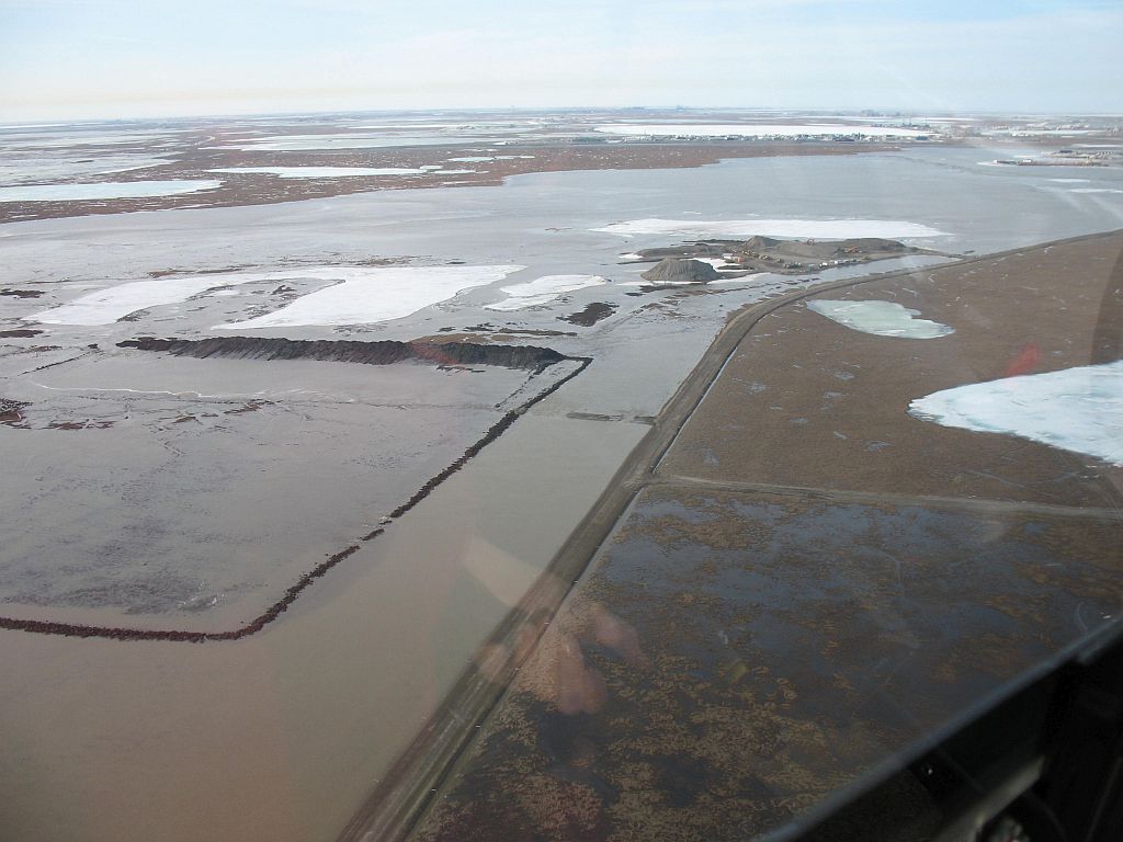
May 20, 2015 4:00pm
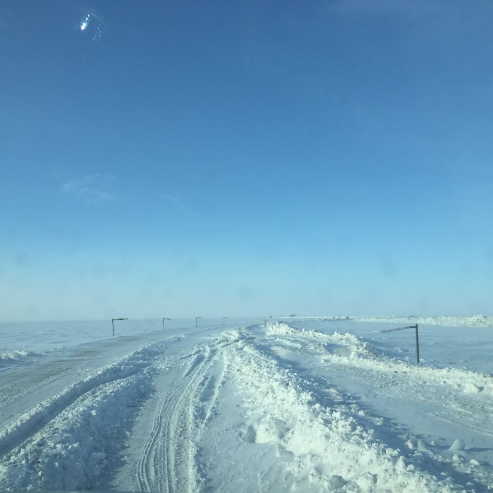
The roadway remains closed from about Mile 335.5 to 413 due to severe flooding and washouts. Staff continue putting in more manmade trenches
in the road to help move water from the west side of the road to the east, where it naturally flows northeast.
We are seeing more flooding in and around Deadhorse. Water was crossing the Deadhorse Airport access road that leaves the safety area. Maintenance and Operations crews shut off access to this road. Flooding is currently having minimal impact on airport operations. Runway lights have been turned off at the airport, which changes the landing requirements for pilots.
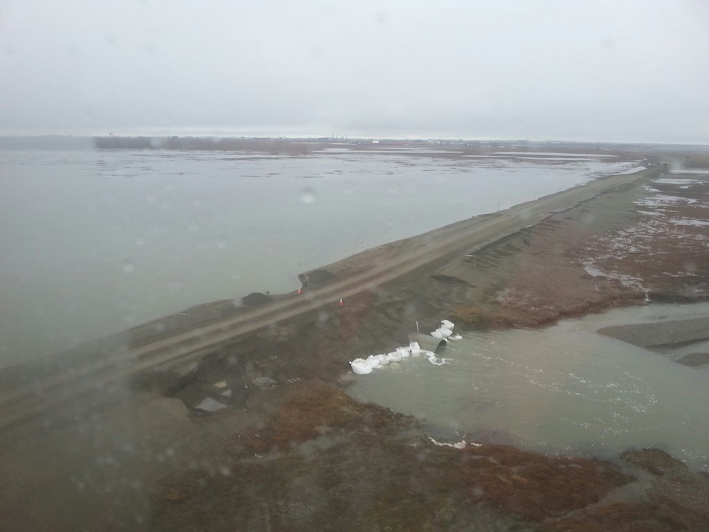
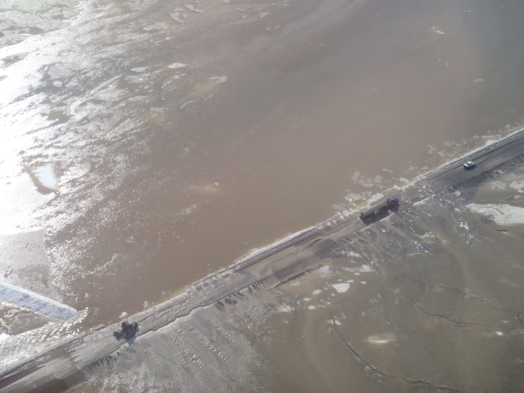
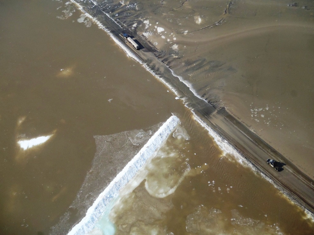
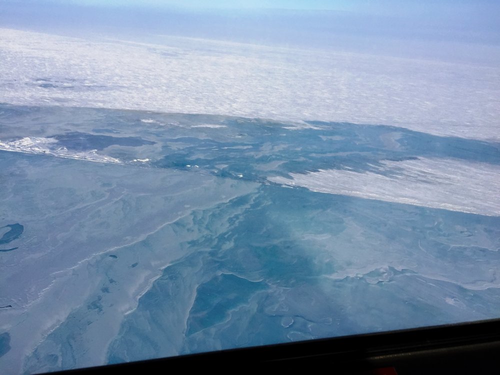
Photos: Water is seen around the southeast end of the runway. Water flows overtop the road at Mile 413.
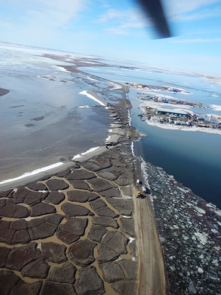
Photos ADOT&PF: Click on image for larger size.
May 19, 2015 4:15pm
The highway is still closed from approximately Mile 335 to 412. The water in the flood zone continues to rise, and we expect this to continue for
the next couple of days. The most extreme flooding is from about Mile 391-413. On the north end, it’s about a mile outside Deadhorse.
On the southern end, the closure now starts at Mile 335.5. There are a few sections between Miles 335.5 and 391 that are flooding, but they are more isolated, not miles of flooding.
We are seeing washouts on the highway and are staging equipment and material so we can start repairs as soon as the water recedes. Staff is also installing culverts in the areas they can and working to divert water to these culverts.
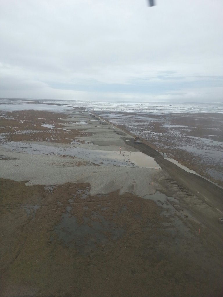
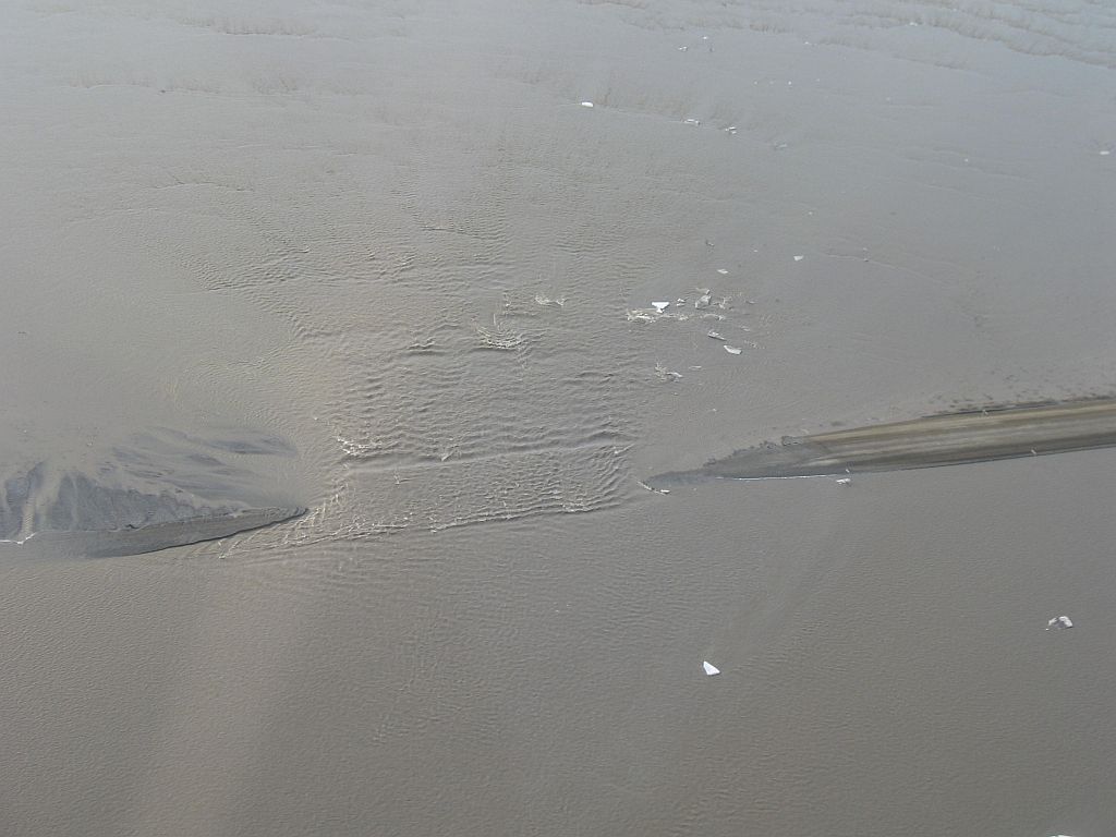
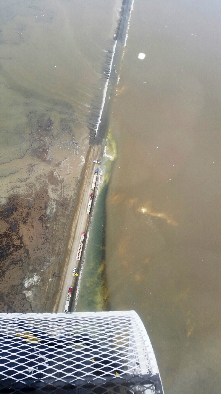
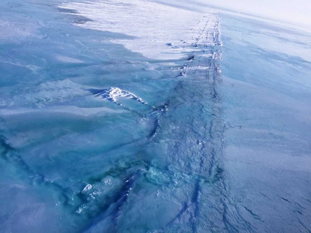
Photos: MP 394.5 and MP 405 looking south from the air.
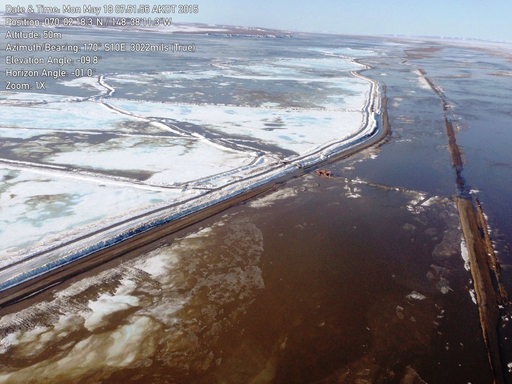
Photos ADOT&PF: Click on image for larger size.
May 18, 2015 3:00pm
Dalton Highway Closed Due to Flooding
Water Level Expected to Continue to Rise, Road Anticipated to Remain Closed Through the Week
(FAIRBANKS, Alaska) — At 12 a.m. this morning, the Alaska Department of Transportation and Public Facilities (ADOT&PF) closed the Dalton Highway at MP 394-403 due to extreme flooding of the road. Water up to 2 feet deep has been reported over the road, and with warm temperatures forecast through this week, the water level is expected to continue to rise. The road is anticipated to remain closed until after the water levels crest; hydrologists with ADOT&PF and the University of Alaska Fairbanks expect this to happen late this week.
Additional resources are joining ADOT&PF staff; personnel and equipment from Cruz Construction will be on site today. The goal will be to try to protect the road surface from erosion by installing culverts and building berms to divert the water to the culverts.
In mid-March, this section of the Dalton Highway was flooded with ice and water. The impacted areas continued to expand, and the depth of the ice and water continued to increase. On April 7, Gov. Walker declared the Dalton Highway a state disaster.
A Unified Incident Command was established last month to assist with the Dalton Highway flooding response. The Unified Incident Command consists of: ADOT&PF, Alyeska Pipeline Service Co., BP, ConocoPhillips, ExxonMobil and the North Slope Borough. The group is in frequent contact and is coordinating efforts.
The Alaska Department of Transportation and Public Facilities oversees 249 airports, 11 ferries serving 35 communities, 5,619 miles of highway and 720 public facilities throughout the state of Alaska. The mission of the department is to “Keep Alaska Moving through service and infrastructure.”
Updates on the Dalton Highway are being posted in these locations
- Dalton website, with photos: https://dot.alaska.gov/nreg/dalton-updates/
- Travel conditions: 511.Alaska.Gov or call 511
- ADOT&PF Facebook: www.facebook.com/AlaskaDOTPF
- ADOT&PF Twitter: @AlaskaDOTPF
- ADOT&PF Flickr: https://flic.kr/s/aHskab652W
Photo: Dalton Highway MP 394 flooding and erosion of the road on May 18. The road surface is located between the delineators.

Photo ADOT&PF Click on image for larger size.
May 18, 2015 9:00am
CLOSURE: The Dalton Highway is currently impassable from approximately Mile 375-412 and has been closed through this section. Water is
crossing the road, up to 2 feet deep in areas, and road washouts have been reported. This advisory will remain in effect through Thursday
or until further notice.
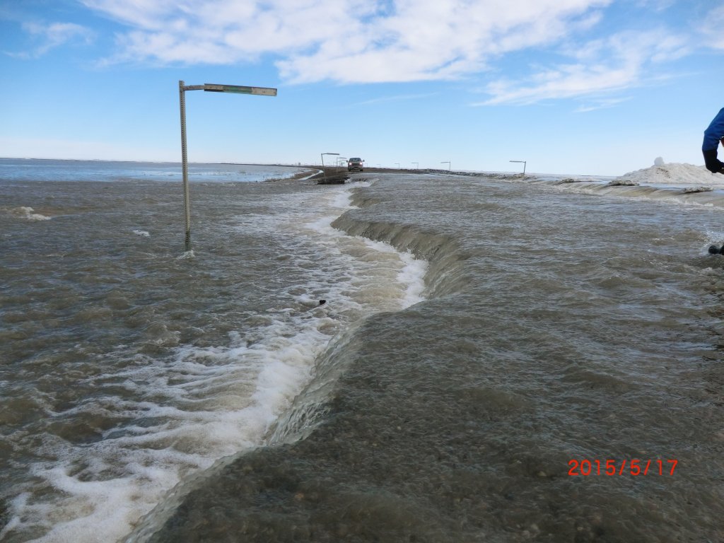
Photos: Water crosses the highway in these photos from Sunday, May 17.
Photos ADOT&PF: Click on image for larger size.
May 7, 2015 3:00pm
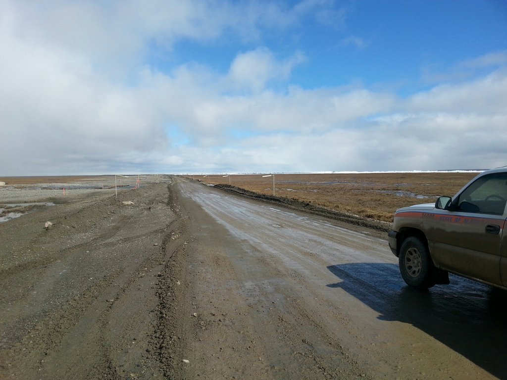
Flaggers have been removed from the work zone, and the road remains open to all traffic from Miles 395-405.
We ask that drivers continue to use caution through the area as maintenance staff are still working to remove ice from the roadway and to patch holes. A significant amount of ice remains on the surface in some areas.
Small water crossings are present throughout this section of the highway. Please watch for signs and reduced speeds.
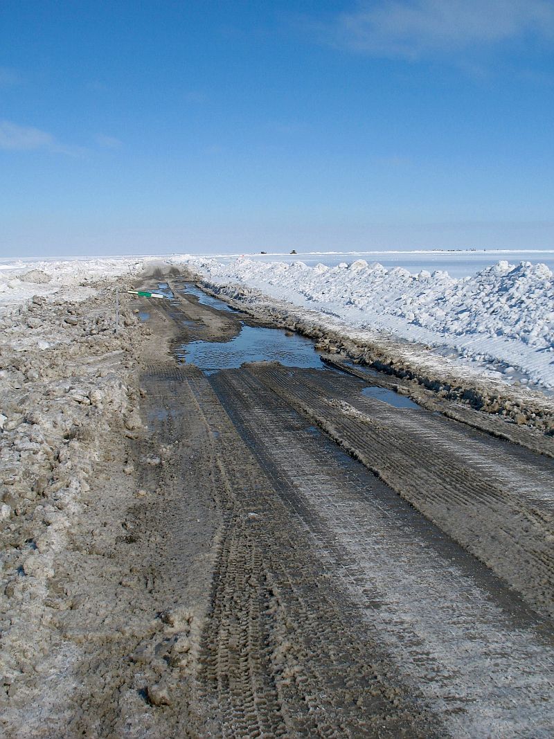
May 5, 2015 3:00pm
The road remains open 24 hours per day. Flagging operations are still in effect from Mile 399 to Mile 404 to allow staff to continue maintaining the
road throughout the day. Drivers are advised to watch for workers and equipment. We are seeing more water and slush on the surface as ice on the
road melts.
Trenching efforts are complete on the east and west forks of the river. Contractor staff will continue to maintain the trenches by the road to ensure the trenches keep moving water away from the highway.
We continue to monitor spring breakup with Alyeska and the University of Alaska and will conduct a breakup study starting next week.
Photos: Maintenance crews continue removing slush from the roadway as ice on the surface melts.
Photos ADOT&PF: Click on image for larger size.
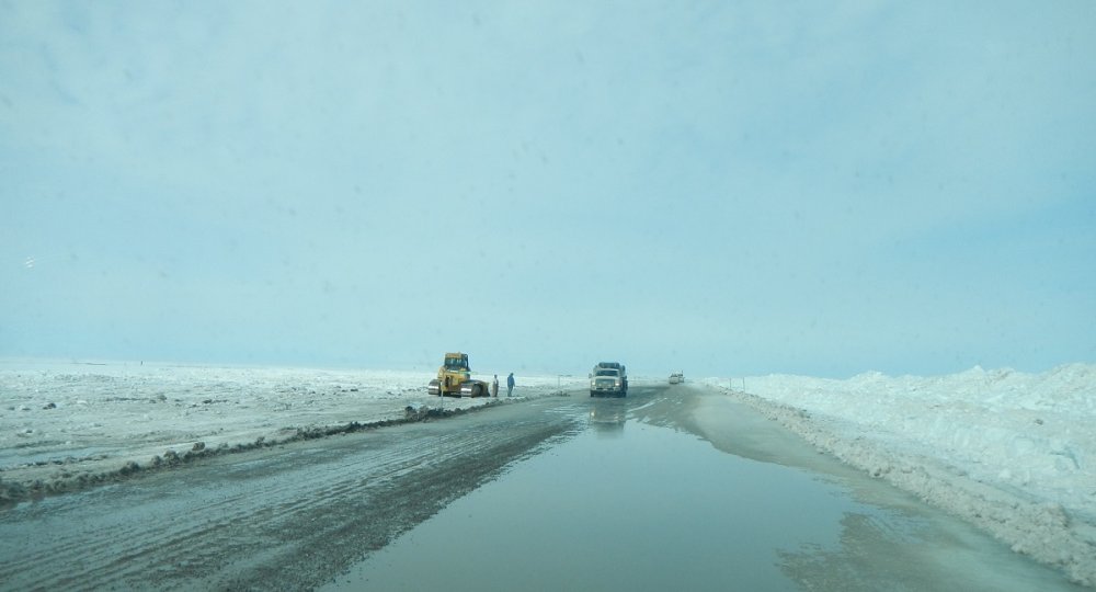
April 28, 2015 8:30am
There is no longer a pilot car, but flagging operations remain in effect. Miles 400-404 are still predominantly covered in ice, with up to 3
feet remaining on the surface. We will continue flagging operations while this ice melts, to allow maintenance staff to safely clear it
from the roadway and smooth the road surface. Expect delays of up to 15-20 minutes, and watch for workers and equipment. All load widths
may transit the work zone.
Crews are closing in on finishing up the main channel trench. We also are working to open as much of the east fork as possible before breakup.
For video of trenching work by the road and on the west fork from last week, visit https://www.youtube.com/watch?v=rDyz0Zij5tM
As travel restrictions have been lifted, we are reducing the frequency of posts on this page and will update it next when things change.
April 26, 2015 6:20pm
As of 5 p.m. today, all load widths may now transit the work zone from Miles 395-405. Flagging and pilot car operations will
continue, as equipment is working on the road to continue pushing back berms, smoothing the surface and removing ice from the
roadway. The road remains in good condition, though there is a significant amount of ice on the surface in areas that is beginning
to melt. Much of the melt right now is being seen at either end of the work zone.
As the area gets closer to breakup, trench work continues. We are wrapping up expanding the trench on the west fork of the river and are now focusing our efforts on opening up as much of the east fork as we can while conditions allow. This trench work is being done to direct water away from the road and help water flow smoothly past the area.
This photo shows work that is starting at the east/west channel fork to create a berm to divert water earlier on.

Photo ADOT&PF Click on image for larger size.
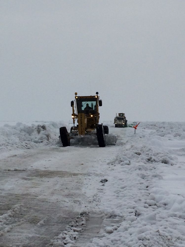
April 24, 2015 6:00pm
Crews continue making progress in widening the roadway in the work zone (Miles 395-405). This weekend, we'll continue widening
the remaining narrow sections and smoothing out the roadway in areas where we've pushed back the berms. We anticipate returning
to normal traffic operations (two lanes, no flaggers) early next week.
Until then, the flagger zone remains approximately Miles 399-403, and we are allowing loads up to 18 feet wide.
We're also expanding trenching efforts on the east fork of the river. So far, our trenches have focused on the west fork and the area parallel to the road on the east side. This is part of our preparations for breakup. While we had cooler temperatures out there today, a couple days this week saw temperatures above freezing, which is leading to more water flow in the trenches.
Photo: Work this weekend includes smoothing out sections where the berms were recently pushed back, such as on the right side of the road here.
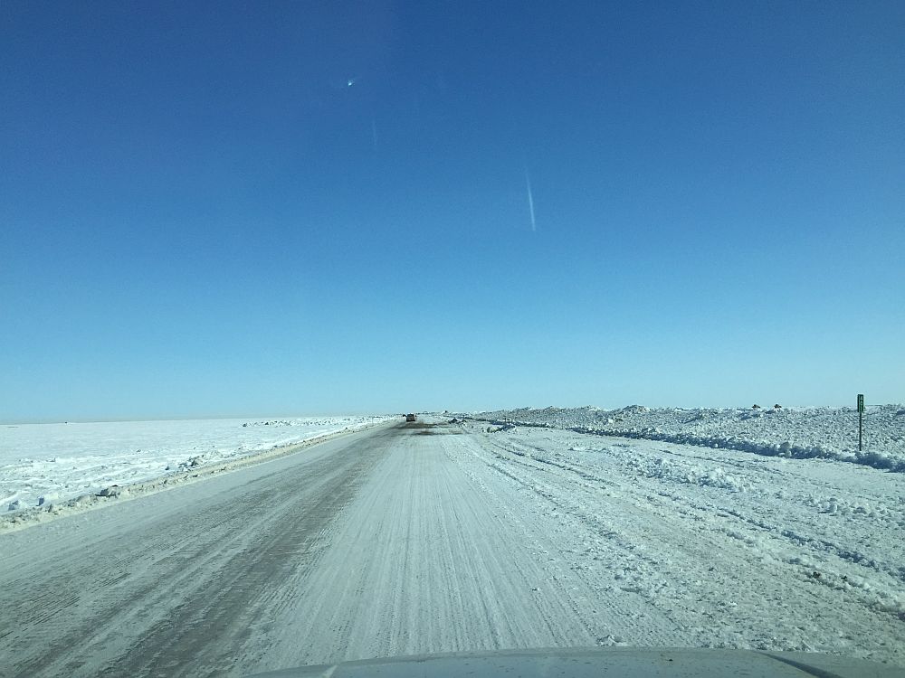
Photo ADOT&PF Click on image for larger size.
April 22, 2015 6:00pm
The road is open to 24-hour commercial and private vehicle traffic.
- We are now allowing loads up to 18 feet wide. We hope to open the road to all load widths within the next few days. We continue widening efforts to open more of the roadway to two lanes.
- The road remains in good condition, though a little water is coming onto the highway near Miles 397-398.
- Flagging operations are still in effect from about Miles 399-403.
- Transit time is averaging 15-20 minutes through the work zone with some delays.
- Chains are no longer mandatory.
April 22, 2015 11:00am
The Dalton Highway between Miles 395 to 405 remains in good condition. The highway is open to commercial and private vehicle traffic 24 hours a day.
The road is not yet fully open to two lanes in that section. Pilot cars continue to lead traffic between about Mile 399 to Mile 403.
We are not requiring chains at this time. Low boys and double drop trailers may transit the work zone, but we have paused allowing loads wider than 12 feet until about 5 p.m. today. This will allow maintenance crews to finish clearing snow off the roadway from the storm yesterday. We expect to resume allowing loads wider than 12 feet this evening. We’ll have an update on this later today.
Trenching efforts to divert water away from the road are ongoing. In addition, we continue to monitor spring breakup in the area and are working with a forecaster to analyze this year’s breakup.
Left: A pilot car leads a wide load through the work zone as snow starts to pick up Tuesday, April 21, 2015. Shortly after, we had to pause allowing wider loads through to give maintenance staff time to clear snow from the roadway. Right: The road is seen after the skies started clearing up and work was being done to blade the snowdrifts off the road Tuesday.
Photos ADOT&PF Click on image for larger size.
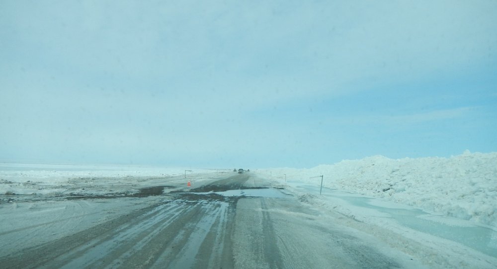
April 19, 2015 8:00pm
- The road remains in good condition and open to traffic 24 hours a day.
- We continue to see more water in the trenches, overflow in areas beside the roadway and water seeping through the berms onto the highway; however, the deepest water on the road today was only a few inches.
- Loads up to but not in excess of 12 feet wide are still allowed. Crews are continuing to push back the berms in an effort to open the roadway to wider loads. Water behind the berms is slowing progress on this. Steps are being taken to widen the section of roadway between Mile 402 and 403 starting Monday. We can’t widen Mile 400-401 until water levels decrease; the berm is holding back an incredible amount of water. We are creating a new trench to help divert some of this water.
- Low boys and double drop trailers are allowed to transit.
- Chains are recommended but not mandatory. We ask that vehicles who use chains refrain from removing them until well clear of the area to avoid congestion.
- Transit time has been running about 15-20 on average, with further delays to be expected depending on weather conditions and water levels.
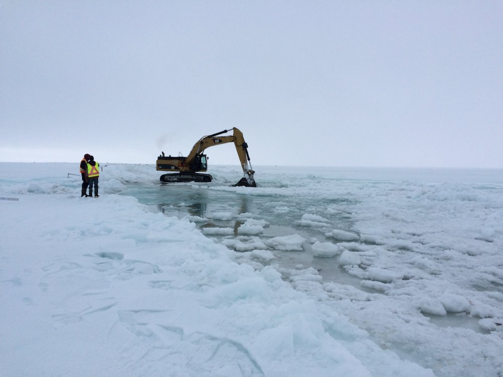
Water seeps through the berms onto the roadway; an amphibious excavator expands the trench beside the road; overflow is seen on the opposite side of the highway as the river.
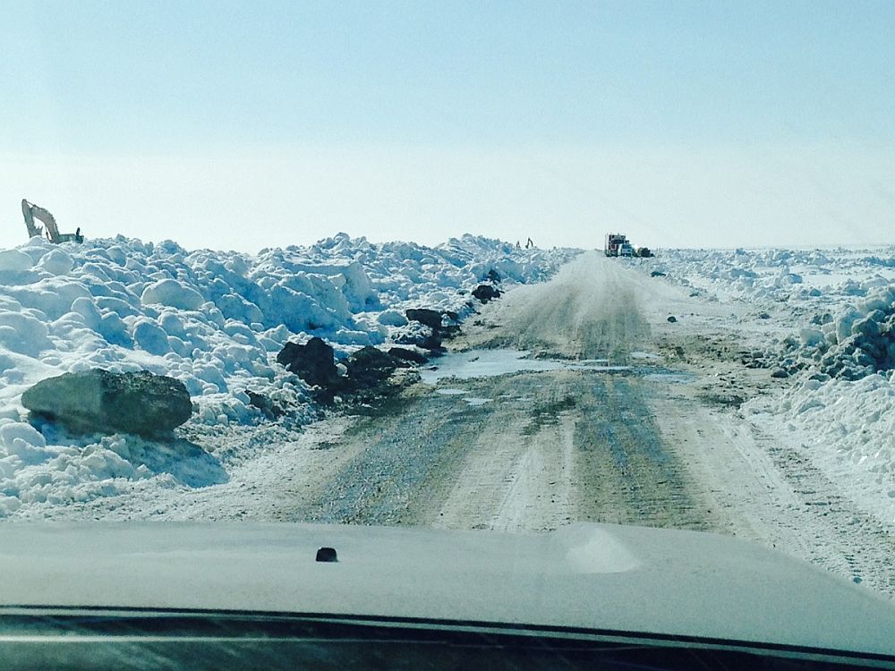
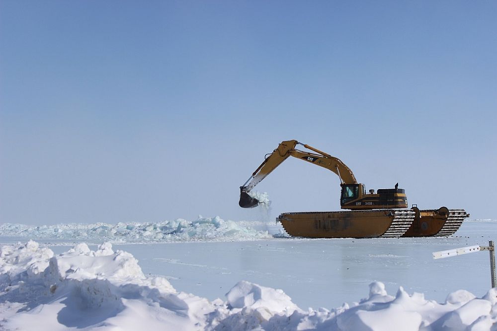
Photos ADOT&PF: Click on image for larger size.
April 17, 2015 7:30pm
ADOT&PF opens Dalton Highway to 24-hour traffic
Flagging operations, some restrictions on commercial vehicles still in effect
(DEADHORSE, Alaska) — The Alaska Department of Transportation and Public Facilities (ADOT&PF) has moved to 24-hour traffic for private and commercial vehicles on the Dalton Highway.
The section between Miles 399-403 still will be controlled by flaggers.
"Opening the road to 24-hour traffic is a milestone in the flood response," said Mike Coffey, ADOT&PF Statewide Director of Maintenance and Operations and the State Incident Commander. "It's been an incredible effort by everyone involved."
The department has also dropped restrictions on low boys and double drop trailers transiting the flooded section of the highway.
Restrictions on loads wider than 12 feet still apply. Crews continue trenching operations and pushing back berms to open more of the roadway to two-lane traffic.
Staff are maintaining the roadway between pilot car convoys to keep the surface smooth.
The Alaska Department of Transportation and Public Facilities oversees 249 airports, 11 ferries serving 35 communities, 5,619 miles of highway and 720 public facilities throughout the state of Alaska. The mission of the department is to “Keep Alaska Moving through service and infrastructure.”
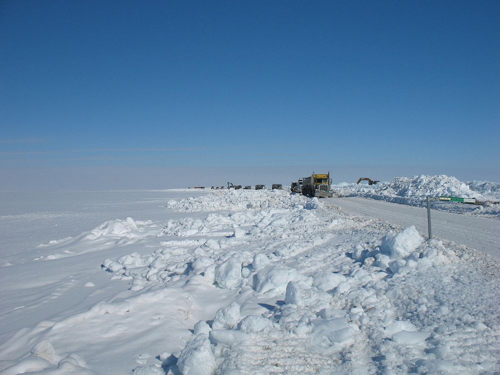
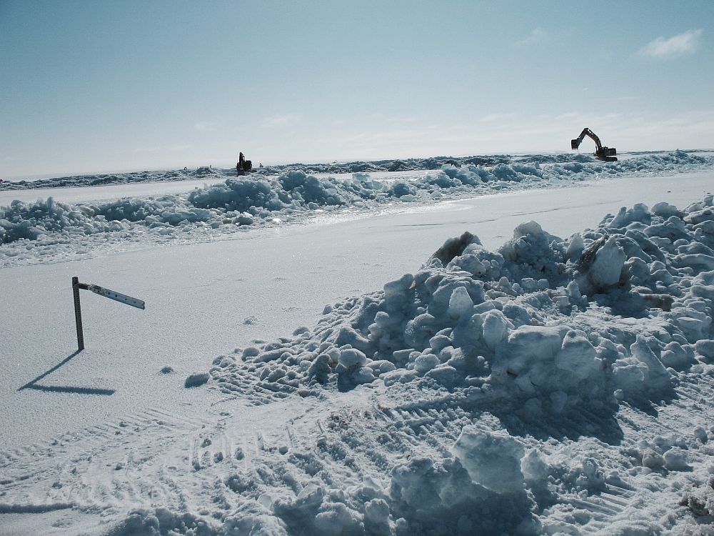
Photo: Trenching operations continue to divert water away from the Dalton Highway.
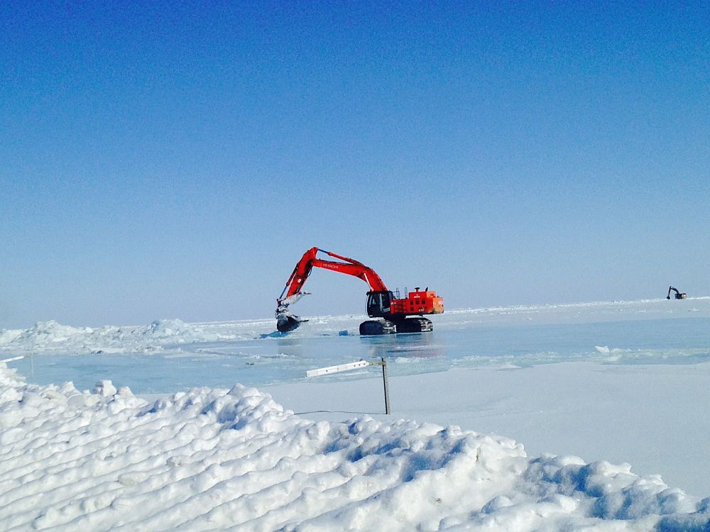
Photo ADOT&PF Click on image for larger size.
April 16, 2015 8:00pm
- Road conditions continue to improve. The deepest spot of water is now down to about 8 inches. Crews continue widening the roadway, cutting down the section of pilot car to about 4 miles, from Mile 399 to Mile 403. The tentative date for allowing wider loads is Monday, dependent upon weather and road conditions.
- Convoys are starting southbound at 7 a.m. with northbound traffic beginning about 8 a.m. We are still alternating north- and southbound convoys of up to 50 vehicles throughout the day, until the road closes for heavy, overnight maintenance around 5:30 p.m. In total, 288 vehicles transited today. The road convoys are operating below capacity with less than 50 vehicles in most convoys.
- Commercial vehicles must use single chains on drive axles. Loads up to but not in excess of 12 feet wide are allowed. Full-size four-wheel-drive private vehicles may travel in the convoys. Traffic is being controlled by flaggers.
- The forecast calls for a blow this weekend; we will continue to prepare for this.
- Long-term spring breakup monitoring continues.
- To view photos and video of the Dalton Highway flooding response, visit http://bit.ly/1E7IaBT
April 15, 2015 8:00pm
The Dalton Highway remains in fairly good condition and is open to full-size four-wheel-drive private vehicles and for commercial
trucks with partial openings and restrictions:
- Access to the flooded section of roadway between MP 395 and MP405 is being controlled with flaggers. It will be open at 7 a.m. for southbound traffic.
- The first northbound release is expected to start about 8 a.m.
- The road will close at about 5:30 p.m. for overnight heavy maintenance until further notice.
- Low boys and double drop trailers will not be able to safely transit road in its current condition.
- Trucks must chain a single drive axle, and refrain from removing them until well clear of the area to avoid congestion.
- Trucks / Trailers with disc brakes are not recommended, because they are more susceptible to freezing up after transiting the flooded portions of the road.
- Drivers should expect an hour and a half transit time, with further delays to be expected depending on water levels and weather conditions.
- Loads up to but not in excess of 12 feet wide will be permitted.
- The current weather forecast indicates high winds and blowing snow starting Friday, which may require diversion of ALL traffic to one of the staging areas. Please adhere to instructions provided by Flaggers, NS Borough Police, and AKDOT.
- Staging areas are currently set up in Happy Valley and Franklin bluffs (for fuel/propane tankers)
- With current weather and road conditions, we anticipate being able to safety escort between 200-300 trucks daily.
- 100 percent weight limits are in effect.
Photos ADOT&PF Click on image for larger size.
April 15, 2015 noon
ADOT&PF suspends seasonal weight restrictions on Parks Highway travel to, from Prudhoe Bay. See the full press release here:
https://dot.alaska.gov/comm/pressbox/arch_2015/PR15-2520.shtml
April 14, 2015 8:00pm
Commercial traffic increases through flooded part of Dalton Highway
Department to open MP395-405 to private vehicles, with restrictions
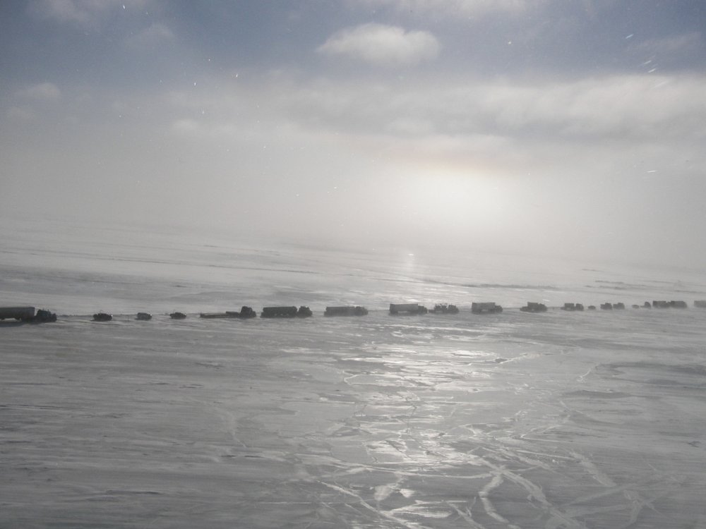
(FAIRBANKS, Alaska) -- The Alaska Department of Transportation and Public Facilities (ADOT&PF) increased commercial traffic today through Miles 395-405 Dalton Highway. Today, 204 vehicles total transited the flooded section of highway. This total includes northbound and southbound traffic.
Convoys of up to 50 commercial vehicles began transiting the flooded section of highway northbound at 8 a.m. Throughout the day, convoys alternated north- and southbound before the road closed at Miles 395-405 about 5:30 p.m. for heavy, overnight maintenance. Flaggers are controlling traffic through the area.
ADOT&PF expects to repeat this schedule Wednesday.
With continued success in managing water levels in the flooded area of the roadway, access to the flooded area is now being opened on a restricted basis for privately owned vehicles. All instructions for privately owned vehicle access will be provided by Public Safety Officers.
- Beginning at 8 a.m. Wednesday, full-size four-wheel-drive trucks will be allowed to transit through the flooded area between Miles 395 and 405.
- Private vehicles are to maintain a safe speed and follow the instructions provided by the flaggers, ADOT&PF personnel and Public Safety Officers.
- As conditions improve, private vehicles capable of safely transiting the flooded area may be allowed to travel in both directions.
- Two-wheel-drive vehicles or those with low ground clearance will not be admitted to the flooded area until routine two-way road operations return.
The focus for crews Wednesday will continue to be reinforcing the snow berm that is protecting the road from flooding. Crews also will continue trenching activities off the road; the goal of the trench system is to divert water away from the highway.
A new aerial tool will be added to the arsenal tomorrow morning if weather conditions continue to be favorable. A crop duster will drop black sand onto the ice covering the main channel of the Sag River. The dark sand will absorb light, and the warmth will help speed the melting of the ice and encourage increased flow away from the road.
The Alaska Department of Transportation and Public Facilities oversees 249 airports, 11 ferries serving 35 communities, 5,619 miles of highway and 720 public facilities throughout the state of Alaska. The mission of the department is to “Keep Alaska Moving through service and infrastructure.”
Left: A convoy of commercial vehicles travels near the flooded portion of the Dalton Highway. Right: Trenching activities continue along the flooded section of the Dalton Highway. These efforts are successfully moving water away from the road.
Photos taken by ADOT&PF on Tuesday, April 14, 2015 Click on image for larger size.
April 13, 2015 7:00pm
ADOT&PF Opens Dalton to Limited Traffic
Commercial Vehicles Can Travel Between 8 a.m to 5:30 p.m.
(DEADHORSE, Alaska) -- The Alaska Department of Transportation and Public Facilities (ADOT&PF) is increasing traffic through Miles 395-405 Dalton Highway. For safety reasons, this is limited to commercial vehicles only. The Dalton Highway between Miles 395 to 405 remains closed to all private vehicles.
Beginning Tuesday, April 14, 2015, convoys of up to 50 vehicles will be allowed through at a time. Access to the flooded part of the highway is being controlled by flaggers.
Northbound traffic will open at 8 a.m. Southbound traffic will start at 10 a.m. for trucks in the staging area by 9:30 a.m. The road will close at 5:30 p.m. each day for overnight heavy maintenance and is expected to reopen the next day at 8 a.m.
Road conditions remained stable as traffic moved through the flooded section of the highway on Monday. State and contractor crews are continuing trenching efforts to move water away from the road.
"The hard work of crews is paying off as we're seeing more water moving away from the highway," said Mike Coffey, ADOT&PF Statewide Director of Maintenance and Operations and the State Incident Commander.
The Dalton Unified Incident Command expects to allow about 100-200 trucks daily through Tuesday and Wednesday, weather permitting. The area forecast calls for favorable conditions through Saturday.
Updates on the Dalton Highway are being posted daily in these locations:
- Dalton website, with photos: https://dot.alaska.gov/nreg/dalton-updates/
- Travel conditions: 511.Alaska.Gov or call 511
- ADOT&PF Facebook: www.facebook.com/AlaskaDOTPF
- ADOT&PF Twitter: @AlaskaDOTPF
The Alaska Department of Transportation and Public Facilities oversees 249 airports, 11 ferries serving 35 communities, 5,619 miles of highway and 720 public facilities throughout the state of Alaska. The mission of the department is to “Keep Alaska Moving through service and infrastructure.”
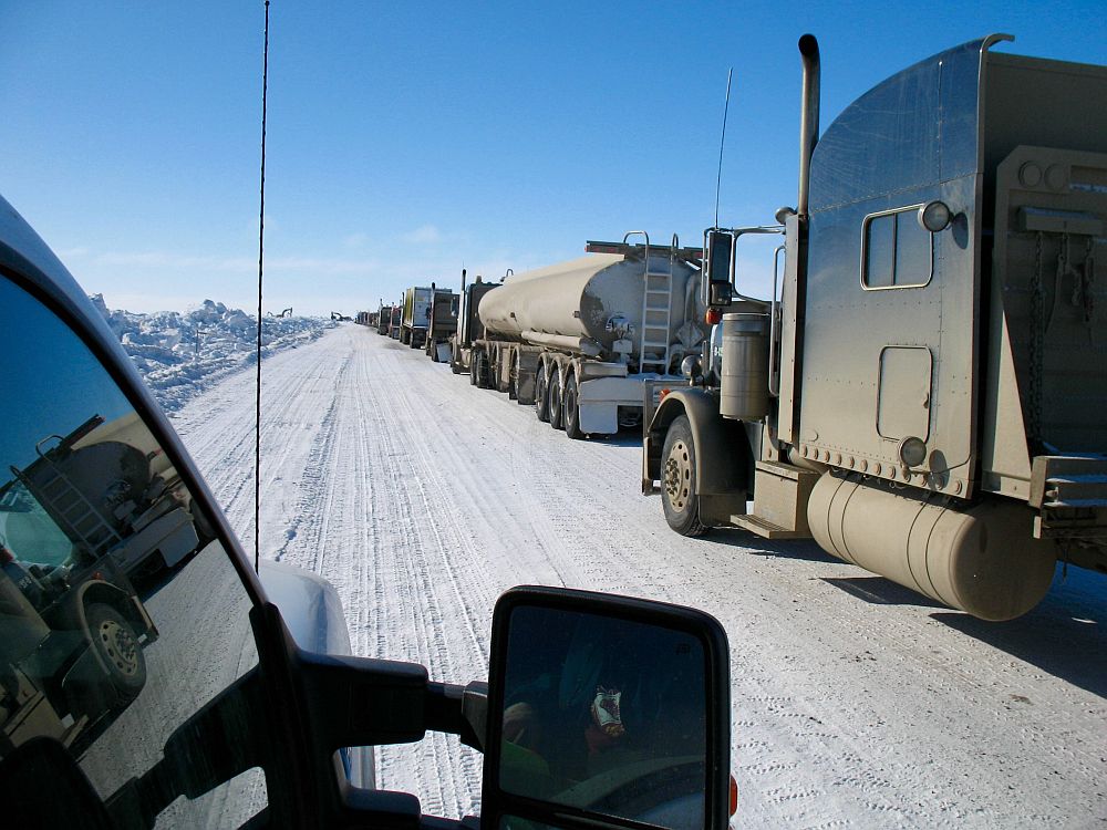
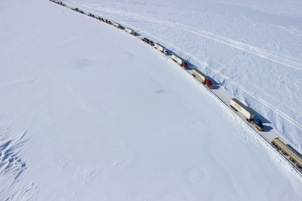
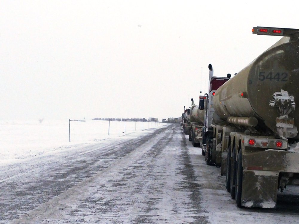
Photo: A convoy of trucks traveling the Dalton Highway near Mile 400.
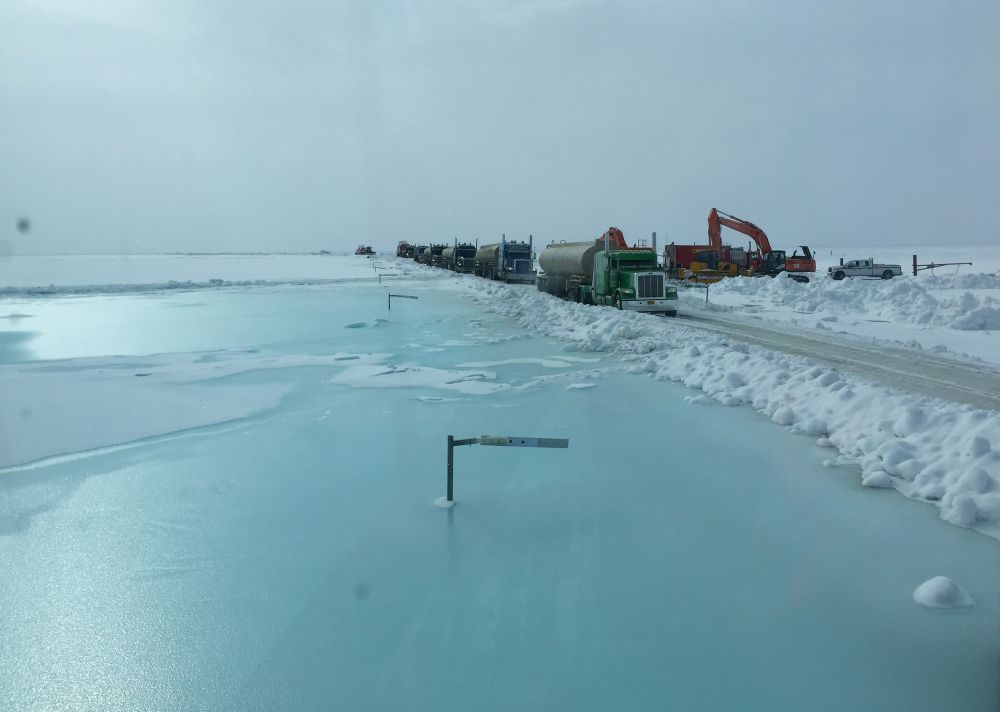
Photo ADOT&PF Click on image for larger size.
April 13, 2015 2:00pm
To contact the Dalton Highway Flood Unified Command:
Phone: 907-685-1760
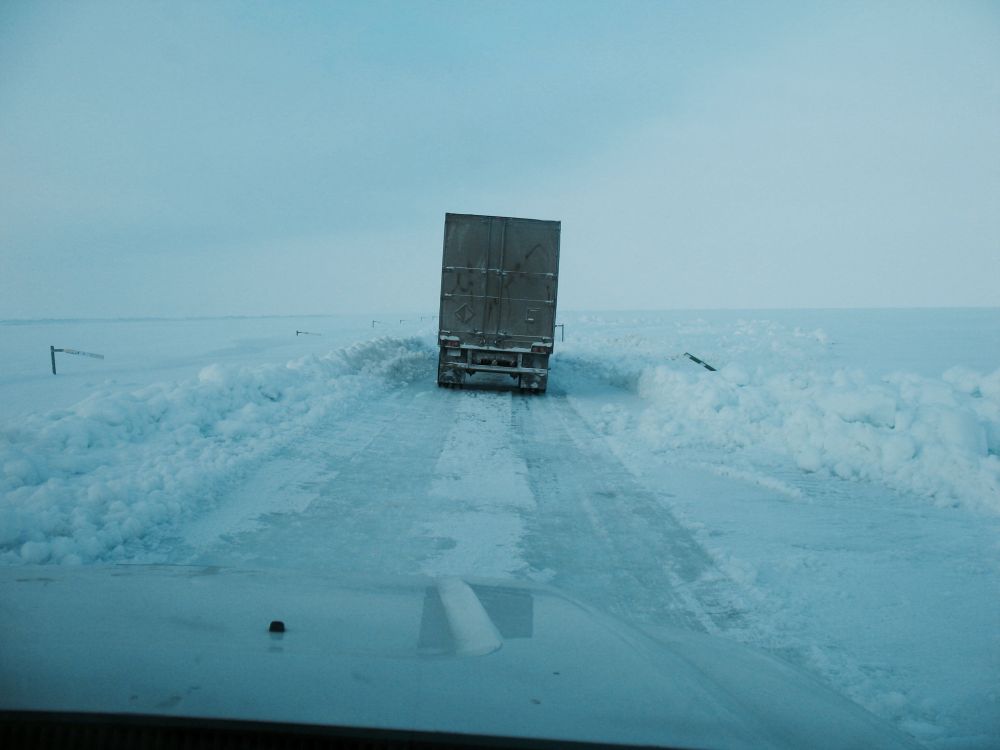
Photo: Trucks moving along the Dalton.
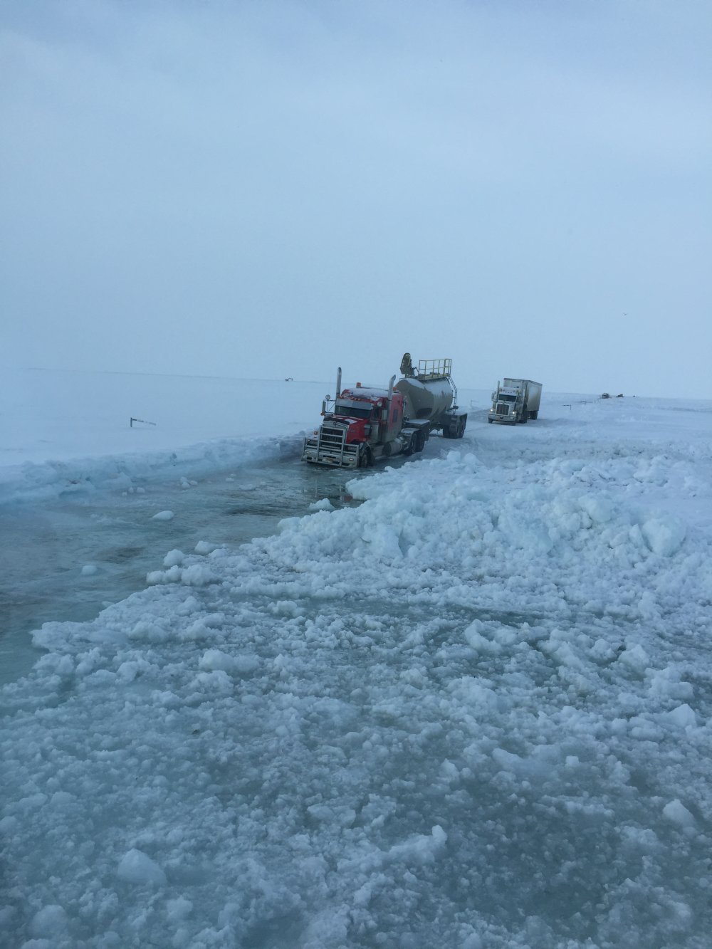
Photo ADOT&PF Click on image for larger size.
April 12, 2015 9:00pm
Dalton Highway Closed Except for Critical Loads
All Loads are Being Approved Through the Dalton Unified Incident Command
(FAIRBANKS, Alaska) — Beginning this morning, the Alaska Department of Transportation and Public Facilities (ADOT&PF) successfully led several permitted loads through Mile 399-405 of the Dalton Highway. This section has been closed to traffic since last Sunday. The Dalton Highway remains closed except for critical loads that have been pre-authorized by the Dalton Unified Incident Command.
As of 6 p.m., 55 trucks had transited the closed section of the highway carrying critical loads pre-authorized by the Dalton Unified Incident Command. Convoys have traveled the highway in both directions. Between convoys, the road is inspected and maintained to ensure conditions continue to be safe for travel.
Response to the flooding on the Dalton Highway is being managed by the Dalton Unified Incident Command, a joint effort between state agencies and private industry. The Unified Incident Command consists of: ADOT&PF, Alyeska Pipeline Service Co., BP, ConocoPhillips, ExxonMobil and the North Slope Borough.
The goals of the Unified Incident Command are to:
- Keep all responders and the public safe;
- Re-establish Dalton Highway traffic flow;
- Ensure accurate and timely release of information to stakeholders and the public;
- Coordinate to optimize highway traffic flow;
- Develop a logistics plan to support North Slope needs; and
- Protect infrastructure and the environment.
"The partnership between the State of Alaska and industry during this phenomenal event is essential," said Mike Coffey, ADOT&PF Statewide Director of Maintenance and Operations and the State Incident Commander. Together, we are able to identify priorities and systematically address those needs. There is a lot of pressure to get loads through, but having a systematic approach is in everyone's best interest and will ensure that the fragile road surface is protected."
As long as conditions on the road remain safe, small groups of pre-authorized trucks will be allowed to travel the highway. A primary objective at this time is to get fuel trucks to Prudhoe Bay. ADOT&PF will make a determination tomorrow based on road conditions whether tanker trucks carrying fuel will be allowed to transit the closed portion of the highway. The Dalton Unified Incident Command will be instrumental in coordinating the efforts to deliver fuel to the North Slope.
Updates on the Dalton Highway are being posted daily in these locations:
- Dalton website, with photos: https://dot.alaska.gov/nreg/dalton-updates/
- Travel conditions: 511.Alaska.Gov or call 511
- ADOT&PF Facebook: www.facebook.com/AlaskaDOTPF
- ADOT&PF Twitter: @AlaskaDOTPF
The Alaska Department of Transportation and Public Facilities oversees 249 airports, 11 ferries serving 35 communities, 5,619 miles of highway and 720 public facilities throughout the state of Alaska. The mission of the department is to “Keep Alaska Moving through service and infrastructure.”
Photo: Empty tankers move south near Mile 400 Dalton Highway.
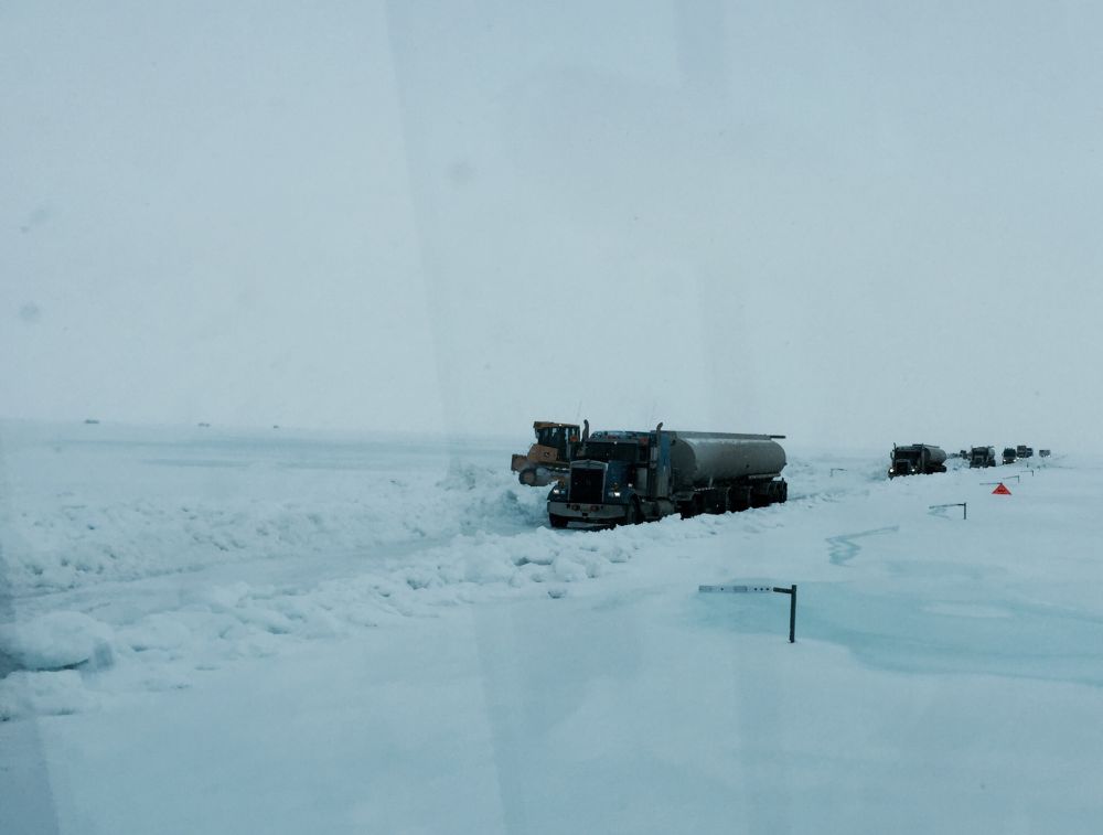
Photo ADOT&PF Click on image for larger size.
April 12, 2015 8:30am
At this time the road is open ONLY to preauthorized loads. TRUCKS WITHOUT PREAUTHORIZATION WILL NOT BE ALLOWED THROUGH.
Dalton Highway Open to Limited Traffic
Travel Limited to Trucks Carrying Critical Loads
(FAIRBANKS, Alaska) — The Alaska Department of Transportation and Public Facilities (ADOT&PF) opened the Dalton Highway to limited traffic at 8:30 a.m. Thirty trucks, carrying what was identified as the most critical loads, are permitted to travel north to Prudhoe Bay. Immediately following, the road will be closed for inspection and maintenance. If the inspection reveals the road is safe, 30 additional trucks will travel south from Prudhoe Bay. This process will repeat, alternating between north and southbound traffic, as long as road conditions are stable.
ADOT&PF and contractors Cruz Construction and Nanuq-AFC worked together, diverting water from the Sag River off the Dalton Highway to improve the road surface. This morning, the effort paid off, and the flow of water over the road between Mile 399 and 405 diminished to a point where vehicles could safely travel.
“I am proud of the tremendous teamwork and herculean efforts of ADOT&PF employees, Cruz Construction and Nanuq-AFC,” said Marc Luiken, ADOT&PF Commissioner. “Everyone involved recognized the importance of the situation, and they rose to the challenge. The conditions are cold and harsh, and the magnitude of this event is daunting. Nonetheless, crews have worked around the clock with the singular goal of opening the Dalton Highway."
Currently, there are 28 people and 26 pieces of equipment working to keep the road open. Excavators are working off the road to break ice and dig a diversion ditch to channel water away from the road. Side dumps are being used to truck snow to the road to build compacted berms to keep water off the road. Plows and graders are working to widen and improve the road surface so it is safe for travel.
Although the road is open, a lot of work remains, and ADOT&PF anticipates future challenges. The Sag River remains difficult to predict, and the warmer spring temperatures due to reach the North Slope will melt snow and ice, producing more water and possibly more instability.
Updates on the Dalton Highway are being posted daily at these locations:
- Dalton website, with photos: https://dot.alaska.gov/nreg/dalton-updates/
- Travel conditions: 511.Alaska.Gov or call 511
- ADOT&PF Facebook: www.facebook.com/AlaskaDOTPF
- ADOT&PF Twitter: @AlaskaDOTPF
The Alaska Department of Transportation and Public Facilities oversees 249 airports, 11 ferries serving 35 communities, 5,619 miles of highway and 720 public facilities throughout the state of Alaska. The mission of the department is to “Keep Alaska Moving through service and infrastructure.”
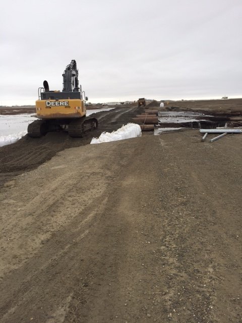
Dalton Highway photos between Mile 399-405. First photo shows the trucks that were driven through to test conditions. Middle two photos show work being done in the most challenging section of the highway, near Mile 401. Final photo shows road conditions on the part of the road not impacted by water.
Photos ADOT&PF Click on image for larger size.
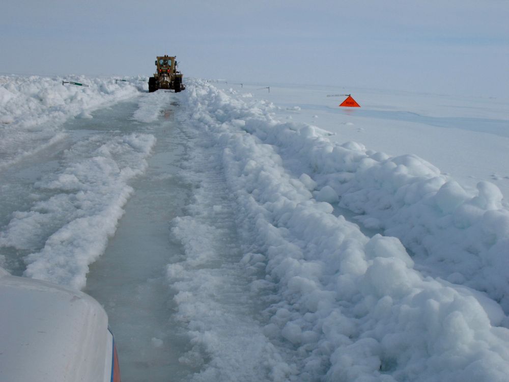
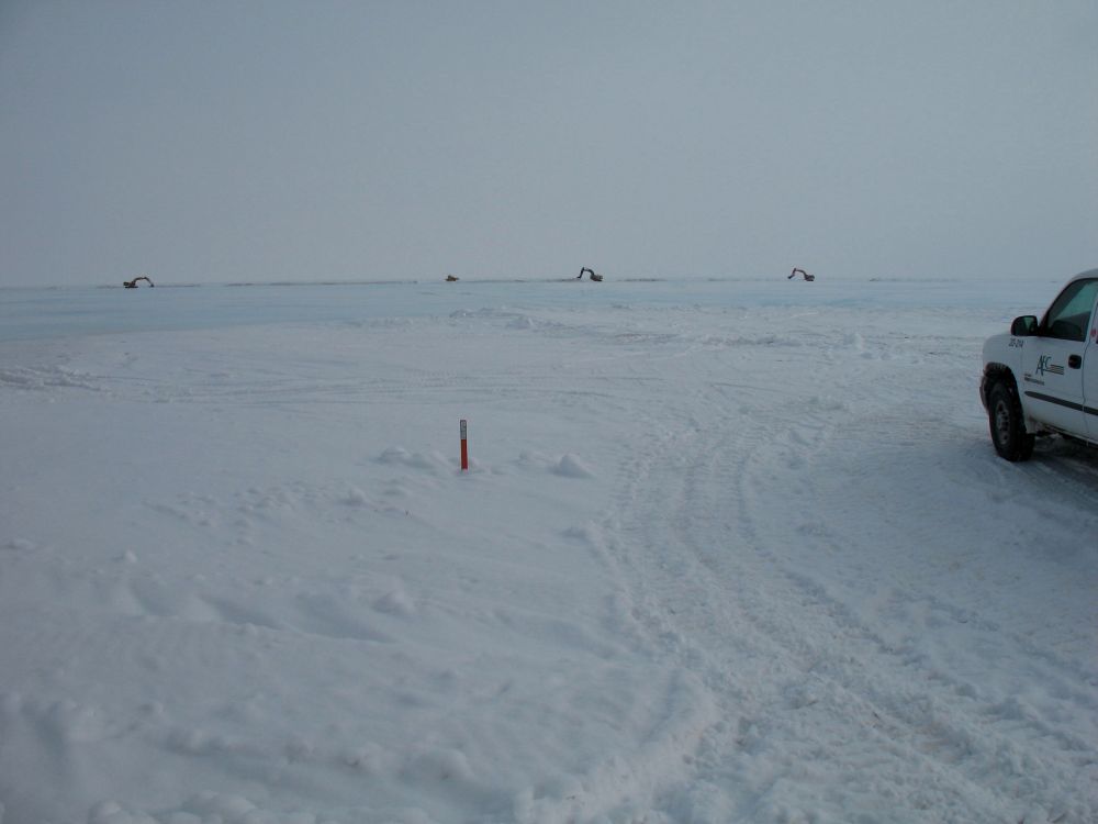
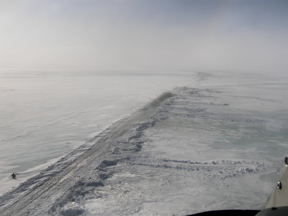
April 11, 2015 10:30am
The Dalton Highway remains closed from Mile 399-405. Crews are working day and night shifts to divert water from the road and to reinforce berms
along the road. The water breaching the road still remains very deep in several locations.
The closure status will be updated Sunday afternoon, or if conditions change.
Photos ADOT&PF Click on image for larger size.
April 11, 2015 9:00am
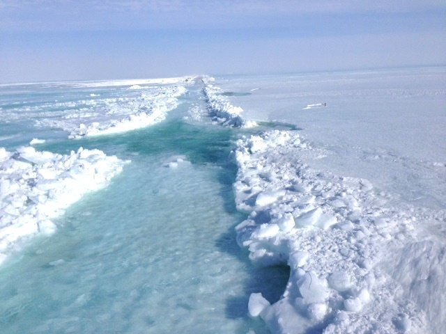
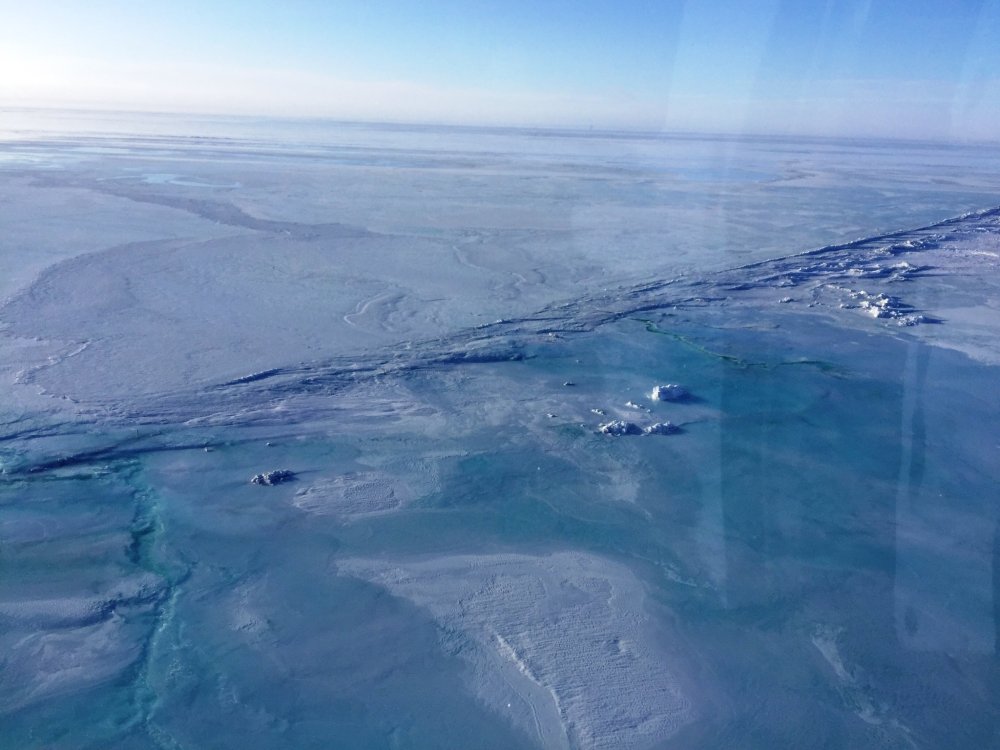
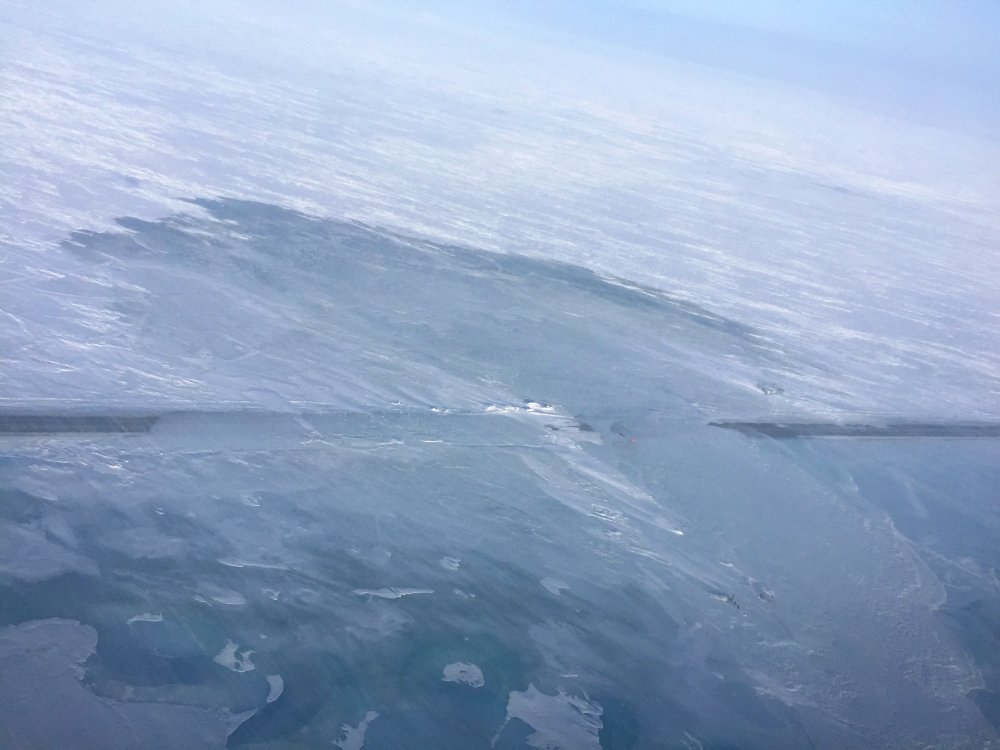
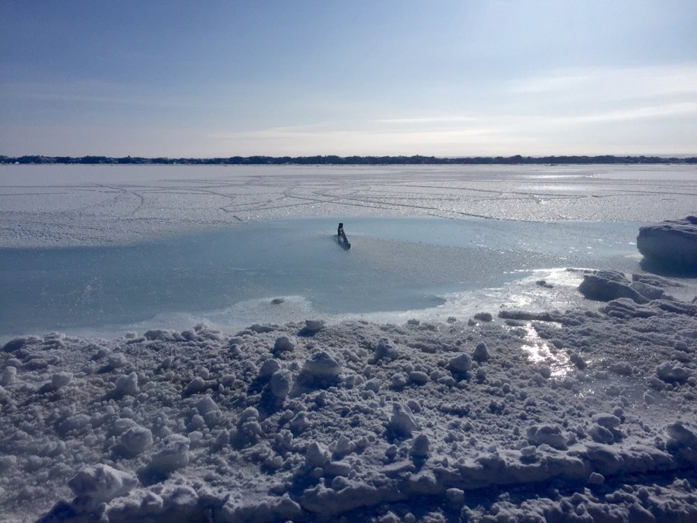
These Synthetic Aperture Radar (SAR) images, taken this month, show areas of surface water on the ice sheet near Miles 399-408 Dalton Highway.
Highlighted red boundaries are around the areas showing water vs ice. Unfrozen water shows up as black with SAR imagery, so one can readily see
the extent of the water that is affecting the highway.
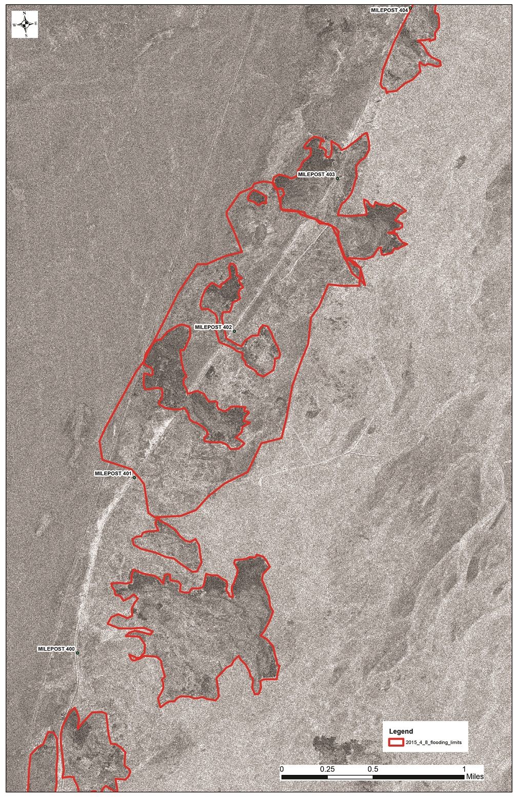
Click on image for larger size.
April 10, 2015 3:00pm
"The Dalton Highway is a vital road, and the magnitude of this event is humbling. There has been tremendous effort put forward so far, and
there will be tremendous effort yet to come. We will get the road open. It is not a question of if, only a question of when.” -
ADOT&PF Commissioner Marc Luiken
Link to full press release: http://1.usa.gov/1GxUuM3
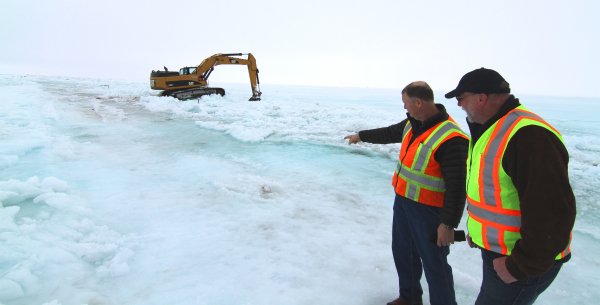
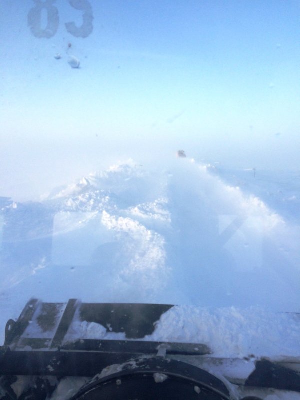
Photo: ADOT&PF Commissioner Marc Luiken and Northern Region Director David Miller survey conditions
on the Dalton Highway at Mile 401
as equipment works to break through ice to divert water from the road.
April 10, 2015 12:00pm
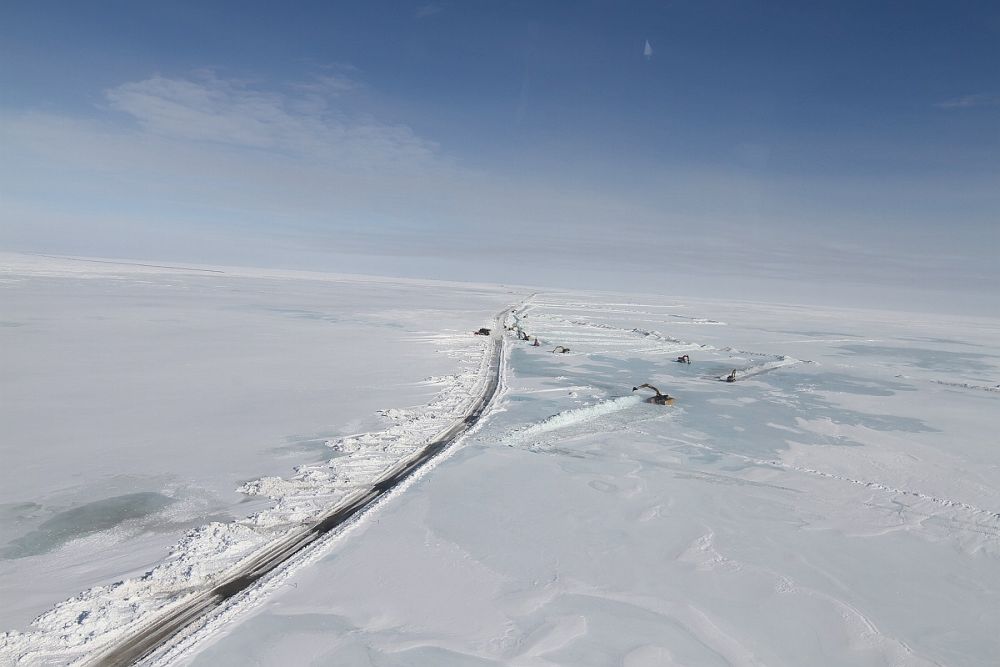
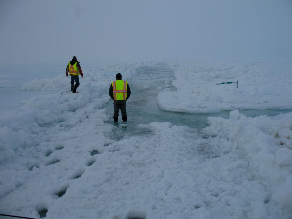
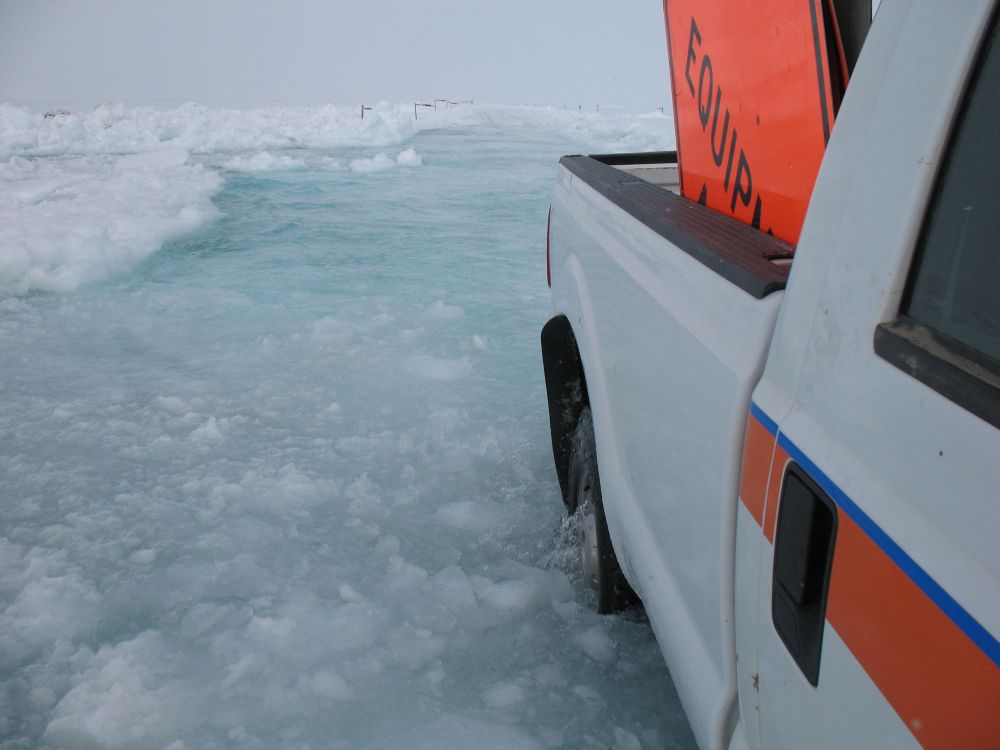
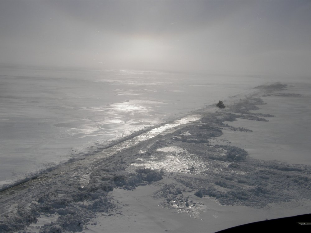
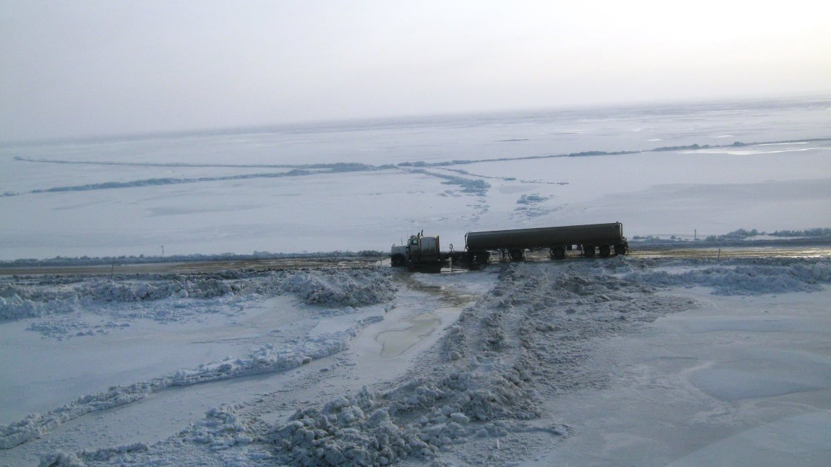
The Dalton Highway remains closed between Mile 399-405. These photos, taken yesterday afternoon at approximately Mile 401, show the challenging
conditions. The delineators sticking out of the ground at the edge of the road are usually 5 feet above the road. As you can see, currently the road
is covered by 3-4 feet of ice. Right now, the big task is to divert the running water from the road; crews are working around the clock to make
this happen.
Diverting water from the road sounds easy, but the conditions complicate this task. It’s still winter on the North Slope, and temperatures are below freezing. The cold temperatures and running water are really hard on equipment. Furthermore, in all directions, for as far as the eye can see, only ice and water is visible, so there is no shortage of water.
Photos ADOT&PF: Click on image for larger size.
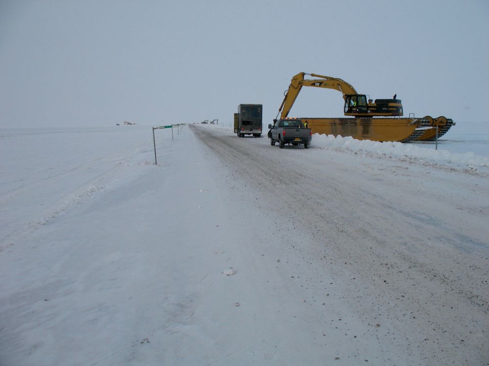
April 9, 2015 4:00pm
The Dalton Highway remains closed from MP 399-405 due to water breaching the roadway. Our maintenance crews are out trying to open the road.
This advisory will remain in effect for the next 24 hours.
In addition, ADOT&PF will suspend temporary seasonal weight restrictions for commercial vehicles traveling the Dalton, Elliott and Steese highways north to Prudhoe Bay.
The department’s Measurement Standards and Commercial Vehicle Enforcement section has implemented the following:
- Commercial motor vehicles transporting commodities to Prudhoe Bay will be allowed 100 percent of legal axle weight on the Steese and Elliott highways;
- Extension of shifting of legal axle weight on drive groups of up to 2,000 pounds per drive axle for 1-3 drive axle groups through April 15, 2015. This applies to commercial vehicles operating on the Steese, Elliott and Dalton highways engaged in providing emergency relief to the Dalton disaster and Prudhoe Bay;
- Expedited processing of commercial vehicles at weigh stations in support of providing emergency relief to the Dalton disaster area and Prudhoe Bay;
- Immediate permit processing of permits requested to move oversized loads or vehicles in support of providing relief to the Dalton disaster; and
- Emergency permitting available outside normal permitting hours for commercial vehicles engaged in providing emergency relief.
All other seasonal weight restrictions remain in effect and can be found at https://dot.alaska.gov/weightrestrictions
April 9, 2015 9:00am
The Dalton Highway remains closed from MP 399-405 due to water breaching the roadway. We have crews out trying to reopen the road.
An update on road conditions will be issued at 3 p.m. today.
April 8, 2015 2:30pm
The Dalton Highway remains closed from Mile 399 to 405 due to water that has breached the road. Crews continue to try and work to open the road.
The next update will be posted tomorrow morning.

Photos ADOT&PF Click on image for larger size.
April 8, 2015 10:30am
On April 7 Governor Bill Walker verbally declared a state disaster in response to flooding that has made the Dalton Highway impassable.
Read the full press release here.
The Dalton Highway remains closed from MP 355-415 due to snow drifts and water on the road. The weather has improved and crews are now out working
to reopen the road. These photos were taken this morning and show current conditions. An update on road conditions will be issued at 4pm today.
Photos ADOT&PF Click on image for larger size.
April 7, 2015
The Dalton Hwy remains closed from Mile 355-414 due to high winds, blowing and drifting snow and zero visibility. Water from the
Sag River has breached the road. Crews are NOT maintaining the road at this time.
April 6, 2015
The Dalton will remain closed for 24 hours due to blowing, drifting snow and water on the road. Crews are not able to keep the road passable.
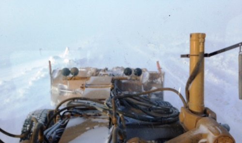
Photo ADOT&PF
April 5, 2015
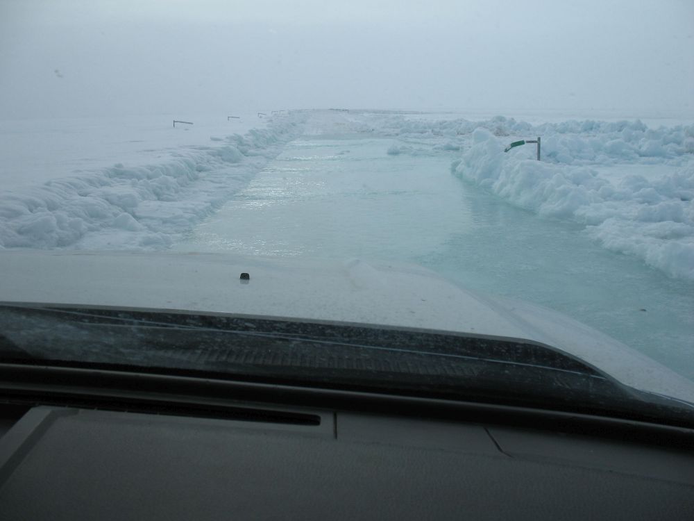
CLOSURE: DALTON HIGHWAY from MP 378 to MP 413 is closed due to blowing, drifting snow and water over the road.
ADOT&PF photos taken at approximately MP 400. Notice the height of the water: Delineators along the edge of the road are usually
5 feet above the road.
Photos ADOT&PF: Click on image for larger size.
April 4, 2015
The Dalton remains open to one lane with traffic control from MP 399-404. There are lengthy delays as we work to get traffic through the
overflow area safely and continue to clear the road.
Aerial photos courtesy of Alyeska Pipeline Service Company, Ground photo ADOT&PF
Click on image for larger size.
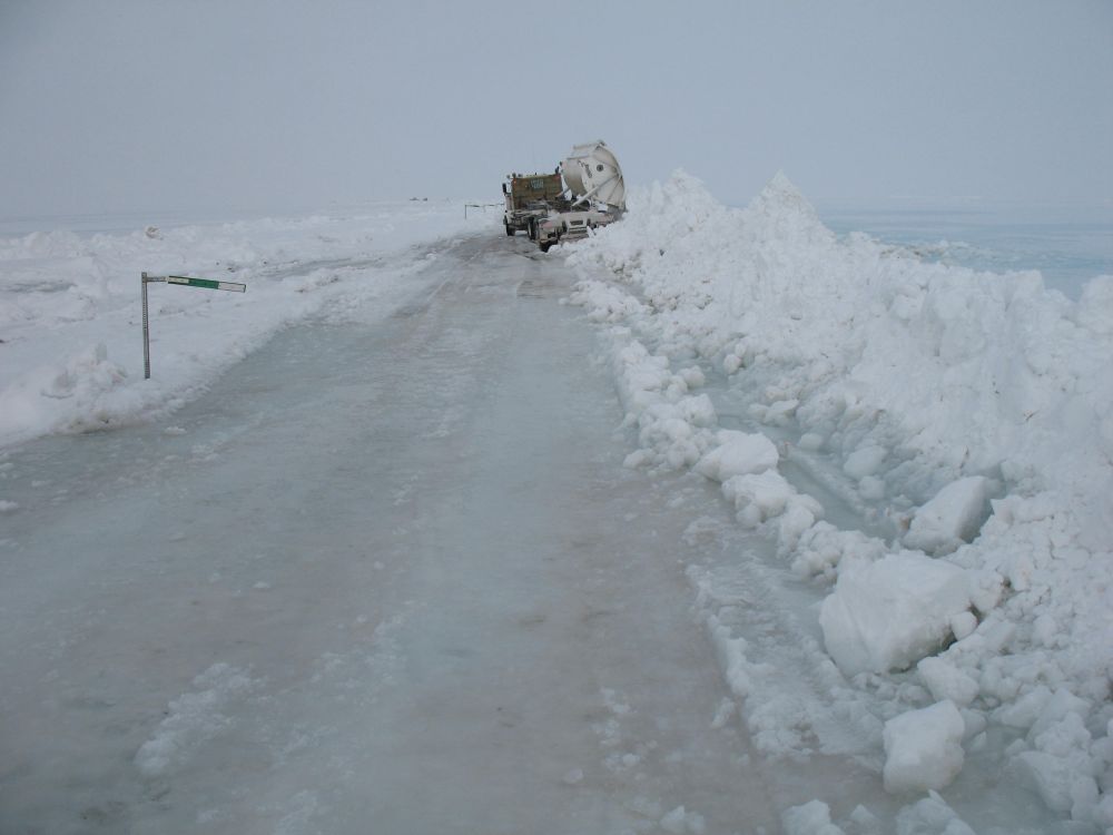
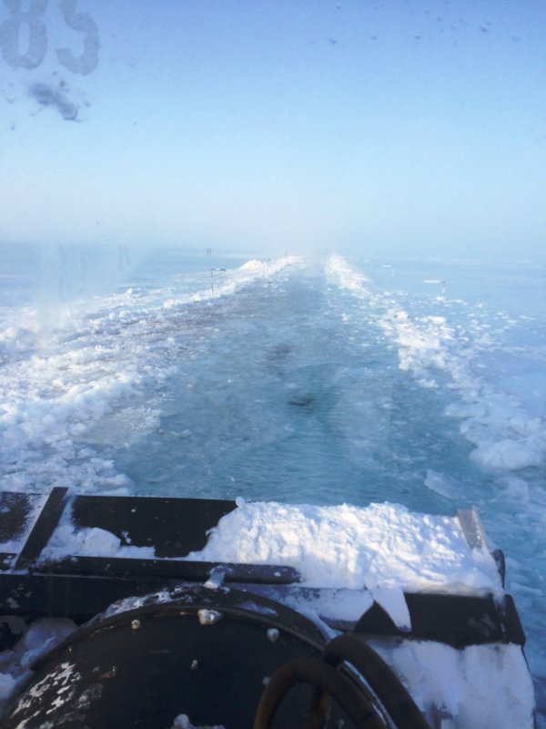
April 2, 2015
Today the Dalton is open to one lane, with traffic control, from MP 399-404. There is still 6-18" of water on the road and chains are
required. The drive was slow and interesting to say the least! Here's the view right outside of Prudhoe:
https://www.youtube.com/watch?v=SeTYSIZOLEs
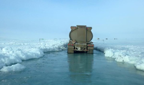
Photo ADOT&PF: 4.2.15
April 1, 2015
The Dalton Highway was closed the evening of March 30 and remains closed from Mile 393 to Deadhorse due to inclement weather and overflow.
Our crews are working extended hours to open the road, and additional resources are on the way. If conditions hold we anticipate being able
to reopen the road by Thursday evening. More information:
1.usa.gov/1IROxYC
Aerial photo courtesy of Alyeska Pipeline Service Company, Ground photos ADOT&PF
Click on image for larger size.
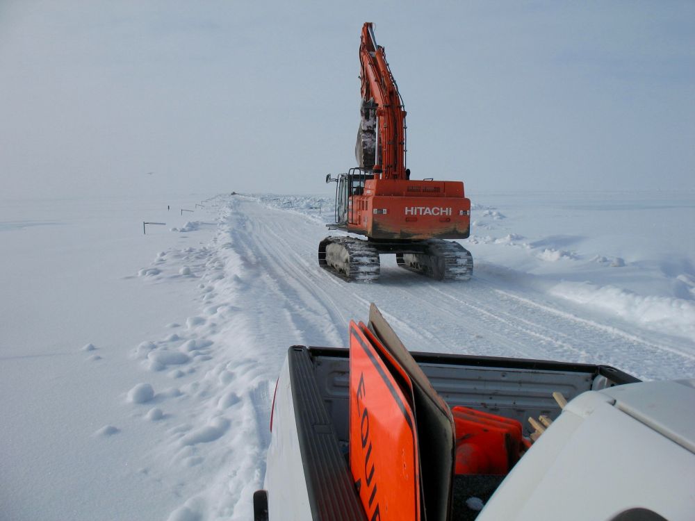
March 23, 2015
We continue to work on the Dalton Hwy MP 392-405 (about 10 miles south of Deadhorse) to minimize overflow from the Sag River. The overflow
started early last week; crews are working to keep the road open.
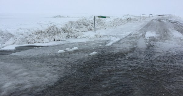
Photo ADOT&PF
March 20, 2015
Dalton Hwy MP 396-405 (about 10 miles south of Deadhorse) - crews are working with
Alyeska Pipeline Service Company
to minimize overflow from the Sag River. The river is currently over the highway in eight locations, the largest spot is 12 inches deep and
200 feet long. The problem started early this week; crews have been at the location 24 hours a day since Monday to keep the road open.
We've been able to use snow and ice to create berms. Today we're using equipment to cut trenches with the goal of diverting the water.
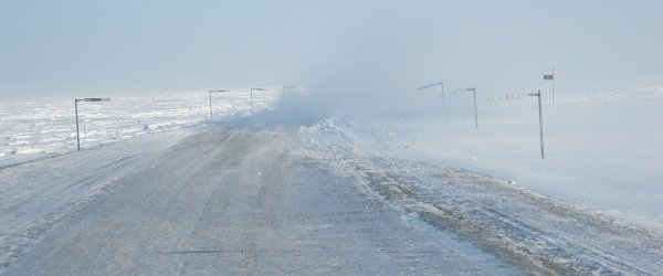

Photo ADOT&PF
Further Information
Media inquiries:
Meadow Bailey,
![]() meadow.bailey@alaska.gov
meadow.bailey@alaska.gov
or call
![]() (907) 451-2240.
(907) 451-2240.
Road conditions are posted at 511.Alaska.Gov, or call 511 from any phone in Alaska.
Travel conditions:
511.Alaska.Gov or call 511
2015: Dalton Highway 401-414 Reconstruction, this project started in 2015 and will continue in 2016. Original construction contract award is $27 million. The scope of the project is to reconstruct the Dalton Highway from Mile Post 401-414, improvements include raising the grade seven feet, replacing culverts and surfacing the road.
In 2015 this project was extended south to MP 397 and the contract amount increased to $43 million due to flooding and repairs.
2016: Dalton Highway 379-397 Reconstruction, scheduled for construction in 2016 and 2017. Construction contract award is $31 million. The scope of the project is to reconstruct the Dalton Highway from Mile Post 379-397, improvements including raising the grade seven feet, replacing culverts and surfacing the road.